Last month I had a bit of a grumble about a designated public footpath that was inaccessible because of a dispute with the local farmer. This month, in more positive vein, I’d like to celebrate the opposite: routes that have no permanent legal status but are made available through the goodwill of the landowner. These are known as ‘permissive paths’, and their status varies. Some are strictly temporary and are declared for grant purposes under countryside stewardship schemes. Others are more permanent and may even be marked on Ordnance Survey (OS) mapping – in orange, to distinguish them from the formal rights of way in green. They often reflect local needs and follow so-called ‘desire paths’, in contrast to public rights of way along ancient lines whose original raison d’être may be long lost and which may be less than ideal for present-day recreational use.
Permissive paths have their disadvantages, of course – they can be withdrawn without notice and, unless marked by the OS, they can be difficult to locate except by chance or local knowledge. I find the community-driven mapping website OpenStreetmap.org a useful source of information about permissive and other de facto paths: in many places, its coverage of unofficial paths is more comprehensive than that of the OS, although, like any crowd-sourced offering, it’s not 100 per cent complete or reliable. OpenStreetmap is how I discovered the permitted path on this route, which allows access to a quiet section of the River Bollin and is made available through the generosity of the Tatton Estate.

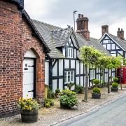
The path lies within the estate of Ashley Hall, a Grade-II-listed house of the late 16th century with later additions. The house’s place in Cheshire history was secured in 1715 when representatives of several aristocratic families met here after George I’s accession (following the death of Queen Anne) to resolve their differences over whether to support the foreign king or the Stuart Pretenders. Their individual votes are not known, but it is said that Mr Assheton, the owner of the house and governor of Chester Castle, made the casting vote in favour of the reigning monarch. The stakes were high: plumping for the wrong side could have led to the loss of their estates, if not their heads. So, a few years later, following the failure of the Jacobite Rebellion, they agreed to commemorate their narrow escape from ruin by commissioning full-length portraits of themselves. For 140 years these paintings hung on the walls of the room in which they had met, but in 1860 on the orders of the Egertons of Tatton they were taken away, cleaned, and rehung in Tatton Hall.
Ashley’s modest church was built in 1880 and is dedicated to Saint Elizabeth. The architect was Wilbraham Egerton, the heir to the Egerton baronetcy, who had purchased Ashley Hall from Mr Assheton’s grandson in 1841. At the time of the church’s completion, he was Conservative MP for Mid Cheshire. Seven years later was appointed the second chairman of the Manchester Ship Canal, and he was made an Earl in 1897.

1. From the front of the pub, turn right and right again into Ashley Road, signposted to Rostherne Mere. After 150 metres, cross the railway above the station, and continue past St Elizabeth’s Church on your right.
2. When the road bends left, turn right through the gate onto the driveway to Ashley Hall, passing a gatehouse on the right. The road bends left and right as it bridges the M56, then continues past the buildings of Ashley Hall. Continue ahead to a further lodge and exit onto the public road. Follow the pavement on the left-hand side of the road.
3. At Coppice Farm, turn left into Ashley Mill Lane. Stay on the lane between buildings and past a layby to a junction, where you turn right. Walk above the steep wooded drop to the River Bollin then, shortly before the mill, turn left onto a public footpath. Rather than following the path across the field (an alternative route, should the permissive path be unavailable for any reason), turn right and follow the edge of the field, above the mill buildings, and down to a bend in the Bollin. Follow the permissive path left, leaving the riverbank to skirt a wooded bend before returning to the riverside. Continue to a second wood, where the path again leaves the river, this time permanently, and proceeds up the side of the wood to meet a track (a public right of way).
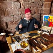
4. Turn right and follow the track above the top of the wood (the home of Into The Wild Bushcraft – refreshments may be available). Stay on the track through fields beyond the wood for 600m or so then (shortly after a footpath on the right) turn left through a kissing gate at the entrance to Ryecroft Farm. Walk down towards the motorway and turn left through another kissing gate onto a footpath along the top of a wood. At the end of the wood, turn right and cross the M56 via a footbridge.
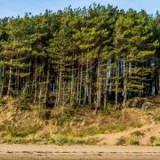
5. Beyond the bridge, turn left along a wooded path along the fence. After a quarter of a mile, bear right, parting company with the noisy motorway, and follow a track along the field edge and past a conifer plantation out to a road. Turn left along the narrow pavement round a left-hand bend.
6. Beyond Birkin Farm, cross with care and follow Lamb Lane for 250m. When the road bends right by a house, follow the footpath ahead, along a field edge. After 100m, turn left through a hand-gate in the hedge, and cross the field ahead to a similar gate in the far left-hand corner. Follow the edge of the next field to the pavilion of Ashley Cricket Club, then continue along the drive out to the road. Turn right and retrace your steps past church and station back to the Greyhound.

The Greyhound
The Greyhound is a neat brick building next to the crossroads in the centre of Ashley. Originally known as the Orrell Arms, it has been serving passers-by for more than a century. You famously never know what the weather’s going to be doing in April, but in a cold snap you’ll doubtless head for the cosy interior with its open fires, whereas if the sun’s out you might head for the beer garden. Dogs are welcome outside, obviously, and also in the bar area, but not in the restaurant.
The menu includes traditional pub standards – fish and chips, steak and ale pie and the like – but there are one or two less mainstream dishes. My vegetarian partner enjoyed her butter bean and cauliflower Goan curry with sweet potato bhajis, her verdict being, 'a cut above the usual veggie curry you get in a pub'. There’s a lunch deal (Monday to Friday, noon to 5pm) of two courses for £14.45 or three for £16.95 and if you’re thinking of sticking around into the evening after your walk, Tuesday night is ‘pie and a pint’ night (£14.95), Wednesday has discounts on bottles of wine, and on Fridays there’s 20 per cent off steaks and grills. On the last Friday of the month you can catch live music, and there’s a quiz every other Tuesday. Beers are from the J W Lees brewery and include their popular MPA pale ale and Manchester Craft Lager.
Parking is only for patrons and assistant manager Jordan Roberts mentioned it would be useful to know if you’re leaving your car before heading off for a walk, particularly at busy times. Parking elsewhere in the village is limited but not impossible – the church car park might be an option, except on Sundays, or you could avoid parking hassles altogether by taking the train direct to Ashley station from Manchester Piccadilly, Stockport or Chester.
Please note the Greyhound is due to close for about a week in mid-April for a minor refurbishment, so do check their social media pages or give them a ring in advance if intending to visit.

Compass Points
Area of walk: Ashley near Altrincham
Start point: Greyhound, Ashley WA15 0QR
Distance: 4½ miles/7.3 km
Time to allow: 2–3 hours
Map: OS Explorer 268: Wilmslow, Macclesfield & Congleton
Refreshments: Greyhound thegreyhoundashley.co.uk
Into the Wild Bushcraft intothewildbushcraft.co.uk
Practicalities: Field and woodland paths may be muddy after rain. Trains to Ashley from Piccadilly, Stockport and Chester. Check closure dates (see above) if intending to visit the Greyhound.


