In the June issue, I completed a list of 90 walking destinations to celebrate the 90th anniversary of Cheshire Life, and it prompted me to revisit one of my favourite Cheshire destinations, and share something of a well-kept secret, this month.
The Ordnance Survey map shows a beguiling public footpath running west from Whitegate village, but the dotted line stops disappointingly at Pettypool Farm. What the map doesn’t show is that a signposted path continues to the lakeside and beyond into open-access Woodland Trust property, before rejoining the public footpath network near Daleford.
Further public and permitted paths from there connect via flooded sand pits to the Whitegate Way for a straightforward rail-trail return. You’ll also visit a hidden stream valley and the pretty village of Whitegate on the outward leg, and the route starts and finishes at a charming community café housed in the former Whitegate Station.
Petty Pool Vocational College is a college and outdoor centre for students with learning difficulties, set within a wooded 40-acre site above the lake of the same name. The original Pettypool House was a country house built by the Cholmondeley family in the early 19th century. Officers of the American 3rd Army were billeted there during the Second World War, but the house was bought by ICI and demolished not long after the war ended.
The college took over the site in 1999 and in 2019 the new Snowy Building was opened, named in honour of former student Mark ‘Snowy’ Griffiths, who had donated significant funds to the organisation. Mark passed away in 2015 at the age of 49.
Whitegate Station Café has a similar community ethos. It opened as a non-profit organisation in July 2015 after the Ranger service moved out and is now run mainly by volunteers. Its stated aims are to provide 'an opportunity for people of all ages and abilities to learn new skills, build confidence and provide tasty refreshments to people visiting the area.' We can certainly vouch for its success in the latter department. Just off route is a well-regarded country pub, the Plough at Whitegate, for those who prefer a pint to coffee and cake – or you could indulge in both.
THE WALK
1. From the Whitegate Station car park, step onto the former railway and turn right, away from the café and road bridge. 400m or so beyond the end of the car park, a footpath crosses, but stay on the Whitegate Way. After a similar distance, leave the trail following a signposted bridleway on the left (if you find yourself crossing a road bridge, you’ve gone too far).

2. The bridleway leads shortly to Dalefords Lane, within sight of a listed thatched cottage. Turn right along the busy road for a short distance. Next to the entrance to Marton Hall on the right, a small plaque draws attention to an ancient cross base in the corner of a field, erected around 1300 to mark the boundary of the Vale Royal Estate. Turn left here into a hedged lane with a footpath sign and a sign for a coarse fishery. Follow the lane to its end, passing an unexpected modernist house called Skeabost. After 200m, a path heads left over a footbridge; to visit the Plough turn left here and climb the hill but otherwise stay on the lane down the pretty stream valley.

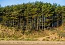
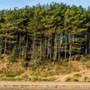
3. When the road swings right towards a farm, take a footpath through a kissing gate on the left and carry on along the wooded bank above the Bogart Brook. Go through a gate into a field near farm buildings and then climb a stile on the left onto a path that runs beside the stream then crosses it via a footbridge to emerge by a fishing lake near Foxwist Green. The path swings left then right over a footbridge over another stream, then winds uphill through woodland to emerge on a metalled lane.
4. Turn left and walk past a property called Coach Barn on the right. After 200m or so, when the road bends slightly left, turn right over a stile in the corner to the right of a driveway and follow the path past a house on the left. Climb a couple more stiles then follow the left-hand field edge, with views to the distant spire of Whitegate church. Cross the corner of the field, then descend across the middle of another field. A footbridge crosses a stream and the path winds between garden hedges to a road junction on the edge of Whitegate village. Turn left and follow the road to the centre of the village.
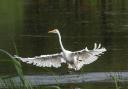
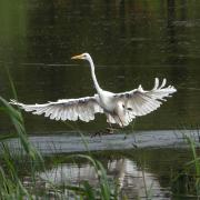
5. Cross and turn right in front of the primary school and climb the shallow steps to the ornate gates into the graveyard of St Mary’s Church. Pass to the right of the church building and exit via the lych gate. Turn left in front of the lodge house at the end of Vale Royal Drive and follow the roadside. Just beyond the end of the graveyard, turn left at a footpath sign onto a fishermen’s access track; the official line of the public footpath goes through a kissing gate on the right, heads left towards the private fishing water known as New Pool, then rejoins the track through a second kissing gate. Go through a wooden hand gate to the left of the lake and continue past a small, reedy pond with a pond-dipping platform on the left (which was alive with tadpoles when we passed by). The path continues beside the lake and then runs alongside its feeder stream through damp woodland. Ignore a signposted permissive path on the left by a stile and continue over a series of footbridges and boardwalks. Although potentially muddy in places, this is a lovely stretch of footpath. Eventually, you cross a final footbridge and emerge in a field within sight of half-timbered Keeper’s Cottage; bear right to a stile onto the track in front of the cottage.

6. Turn left past a small thatched outbuilding, then right in front of a farm gate. Shortly, turn right off the track, onto a shaded path along the garden fence at the rear of Keeper’s Cottage to emerge into a field at the bottom end of Petty Pool. Cross the field, with the lake on your right, to a stile into Pettypool Woods. The path runs parallel to the lakeside for 500m until you reach a stream. Turn left, away from the lake, and continue through the woods with the stream on your right. At a Peak and Northern Footpath Society sign, turn right and descend to cross the stream. By a bench, turn left and continue up the valley, with the stream now on your left. This path winds gradually uphill to a stile into a driveway. Take the path opposite and bear left through a kissing gate into a field. Turn right and walk along the top of the field before descending through trees to the road.
7. Cross with care and follow the byway opposite (with a sign for Daleford Manor Caravan Park). After 100m, turn left and follow the track through the caravan park, then swing right to Daleford Farm. Beyond the farm, leave the track to follow a permissive path on the left that runs alongside a flooded gravel pit. At the end of the lake, you reach a broad track beyond a metal barrier. Turn left for 300m, then look out for a path on the right, which leads you along the edge of another wood, with another gravel pit on the left, before curving left to meet the Whitegate Way.
8. Turn left and follow the former railway for three-quarters of a mile back to Whitegate Station.

Whitegate Station House Café
The railway now followed by the Whitegate Way opened in 1870. It was mainly a freight line, carrying coal to the saltworks in Winsford, and salt in the opposite direction, but a passenger and parcel service was established and ran intermittently until 1931. There were only two stations – the terminus at Winsford & Over and the remote rural station at Whitegate. The line closed for good to all traffic in 1968.
The brick-built Victorian stationmaster’s house and its sunny garden now host a community-run non-profit café, where young people can gain work experience. Supported by a team of part-time staff and a steering group, local volunteers chip in for a few hours a week. On Fridays during term-time, the café is closed to visitors while the co-ordinators work with local children with special educational needs to enhance their life skills. But on Fridays in the summer holidays, and for the rest of the week, the place is open to the public from 10am to 3pm (4pm on weekends). It's cheerful, inclusive, welcoming, justly popular and well deserving of your support.
COMPASS POINTS
Area of walk: Whitegate near Winsford
Start point: Whitegate Station CW7 2QF (free parking until 8pm)
Distance: 6¼ miles/10 km
Time to allow: 3 hours
Map: OS Explorer 267: Northwich & Delamere Forest
Refreshments: Station House Café whitegatestation.org.uk
The Plough at Whitegate ploughwhitegate.co.uk
Practicalities: Several stiles. Field and woodland paths may be muddy after rain. Permitted paths can be withdrawn at any time.