Morwenstow is famous as the home of the Reverend Robert Stephen Hawker, the eccentric parson-poet whose best-known work is rightfully entitled The Song of the Western Men, but affectionately known as Trelawny and considered the Cornish national anthem. Its bombastic lyrics hark back to the English Civil War and are sung lustily at ‘shouts’ on St Piran’s Day, at rugby matches and indeed on any occasion that calls for some Cornish patriotism.
Wild stories abound regarding Hawker’s conduct: his flamboyant clothing, his addiction to morphine, his penchant for japes such as dressing up as a mermaid at full moon to fool the good folk of Bude, or excommunicating his cat for mousing on Sundays. How much of this was the colourful imagination of his biographer (none other than Rev Sabine Baring-Gould) is debatable, but it all makes for a ripping yarn.

Plymouth-born (and buried) Hawker was Morwenstow’s vicar in 1834 until his death in 1875. Smuggling and shipwrecks were rife; Hawker gave Christian burials to lost seamen who would previously have been buried on the beach or left at sea. In the churchyard (near the lychgate), look out for the white figurehead of the Caledonia, which now marks the resting place of five crew washed up in 1842; and a granite cross marked “Unknown Yet Well Known”, close to the graves of 30 or more sailors, including the captain of the Alonzo, wrecked in 1843.
You’ll also see two buildings erected by Hawker. Just off the South West Coast Path is Hawker’s Hut, built from driftwood and with splendid views over the Atlantic Ocean. Hawker spent many hours here, deliberating, writing and smoking – it's now the smallest property in the National Trust’s portfolio.

The walk ends by passing Hawker's vicarage, with its hotchpotch of chimneys modelled on the towers of the churches in his life, including that of Magdalen College, Oxford (the old kitchen chimney is a replica of his mother's tomb).
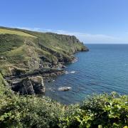
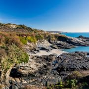
Head north on the South West Coast Path, and on a good day you will have excellent views of the rump of Lundy Island, 10 nautical miles out. We turned inland at Marsland Mouth, where the mill leat forms the border with Devon. The woodland, heathland and maritime grassland here was first turned into a nature reserve by chocolate magnate Christopher Cadbury, and you’ll pass a memorial stone to that effect.
As you follow the inland route back to Morwenstow, you’ll see the white dishes of GCHQ Bude, which collects data essential to its operations in intelligence and cyber-security. Keep your eyes peeled, too, for Marsland Manor, a Grade II* Listed farmhouse dating from the 16th century and reputedly one of the most interesting and picturesque old houses in Cornwall.

The walk
1. From the car park, follow the footpath signposted Morwenstow-Vicarage Cliff. Upon reaching the South West Coast Path, follow the fingerpost left.
2. To visit Hawker’s Hut, look out for a slate marker to the right, and follow the steps down to the hut.
3. Retrace your steps to the finger post. Carry on along the South West Coast Path.
4. Reach the Tamara C2C fingerpost. Here, if you can’t face any more upward inclines, turn right for a shortcut to 6. Otherwise carry on ahead. Where the path meets a T junction with a bench, turn left to descend to Marsland Mouth, where a wooden footbridge crosses the water into Devon.
5. Retrace your steps to the T junction, and carry on straight ahead, up a slope and past the Christopher Cadbury memorial on your left. Pass through a wooden gate.
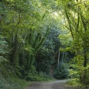
6. At a junction, take the track passing a house to your left, then turn right at a T junction, past Marsland Manor. Look out for a stile and permissive path on your right. Go through a field and into a wood.
7. At a wide lane, turn right and pass over a bridge. Climb over some tree roots to find a stile leading into a field. Strike out for another stile in the hedge opposite (not immediately visible).

8. Cross another field, pass through the metal gates opposite and walk along a track towards Cornakey farm. Go through the farmyard and turn left.
9. When the road bends left, take a track to the right. Pass through a wooden gate, then turn left between a small and a large barn to find a small kissing gate with a yellow handle.
10. Keep to the right-hand side of the field. Go through a gate to hit a track, then turn right at the yellow arrow, pass through a gate and turn left. Look out for a stepped stile over the hedge. Cross the field to find a gate in the left-hand corner.
11. Carry on down the left-hand side of the field to find a gate into the wood. Pass the rectory on your right, and walk through the churchyard, exiting via the lychgate to find yourself back in the car park.

COMPASS POINTS
Distance: 6 miles
Time: 5 hours 30 minutes (including rest stops)
Map: Landranger 190 Bude & Clovelly
Start and finish: Rectory Tearooms, Morwenstow (parking available)
WC: Rectory Tearooms (customers only).


