A rocky coastal walk on the Roseland Peninsula takes in history from the Bronze Age to the Second World War
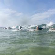
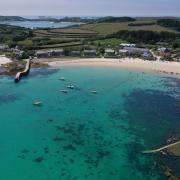
Should one spill the beans about one’s favourite beach? It’s a tough call, but Carne is too good not to share. On the tranquil Roseland peninsula, it’s especially popular with locals for many reasons: the water is deep enough for swimming but shallow enough to be family-friendly, and when the tide is out, there are rockpools galore and the opportunity to walk to the next beach at Pendower (come back via the South West Coast Path).
There’s a good-sized car park which is free for National Trust members, plus toilets and a fantastic cafe - a horsebox offshoot of The Thirstea Co, which has larger premises near St Anthony Head. You might also while away an afternoon over a cream tea (jam first) at the elegant Nare Hotel.
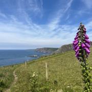
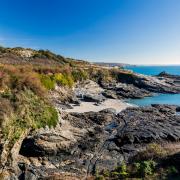
The coast path here is fascinating, and spectacular. Commanding Gerrans Bay is Nare Head (from Penare, or pennardh, meaning promontory in the Cornish language). A Royal Observer Corps (ROC) post was built here to track aircraft at the start of the Second World War, along with a starfish bunker to serve as a decoy for nearby Falmouth Docks; it later observed nuclear activity during the Cold War. Look out for the occasional tour led by a local volunteer expert.
Inland, Carne Beacon is thought to be the largest Bronze-Age burial mound in England. Legend has it that in the sixth century, the remains of King Gerrenius were rowed across the bay in a golden boat with silver oars, and these were buried inside the mound with their royal cargo. However, when the hillock was excavated in 1855, no such treasure was found - only evidence of a Bronze Age cist-style grave with a stone chamber. During the Second World War, it was used as a lookout post – you can still see a concrete pillar from this period, along with great views of the bay.
To get to Carne, follow the main road from Tregony to St Mawes, turning left at the large Roseland garage. You can either follow signs to Carne, down steep single-track country lanes with the vista of the bay opening up before you; or, if the thought of meeting someone coming the other way fills you with dread, take the broader route through Veryan village instead. This has the added attraction of driving between the thatched round houses, built by the Trist Family in the early 19th century and reputedly round to stop the devil from hiding in the corners. (Alternatively, extend your walk here).
A final plea from a local who loves this space, to dog-owners. Your pooches are welcome here, but please keep them on leads around livestock, and note that as the National Trust no longer provides bins due to the remoteness of the location, you will need to take your dog waste home with you for disposal. There is no such thing as the dog poo fairy, but the pile of bags outside the ladies’ loos is very real indeed.

1. Look for the fingerpost in the right-hand corner of the car park. Climb over the wooden stile into a field, walking along the base of the valley (keep dogs on leads as livestock grazes here. Where the faint path splits, bear right up the hill.
2. At the top of the hill, continue across a large, flat area (formerly an Iron Age homestead, known locally as Veryan Castle or Round). Cross a stone stile and follow the hedge down the right-hand side of the field.
3. At the end of the field, go through the kissing gate and turn right to follow a short section of minor road.

5. Descend the beacon the way you came and turn left to exit the field via the stone step stile. Bear left along a minor road, towards tiny Carne village.
6. Walk through Carne village, bearing right and following the public footpath signs.
7. The road ends at an intersection of grassy footpaths. Take the left-hand path and Nare Head will soon come into view.
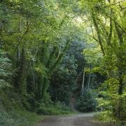
8. Follow the coast path, crossing the footbridge at the base of the valley. Go past the remains of Mallet's Cottage on your right. Turn left opposite the cottage, heading inland through Paradoe Valley woods. Once out of the woods, pass through a kissing gate and bear left along edge of the field hedge line (slippery and muddy after wet weather).
9. Go through a kissing gate past Kiberick car park, cross the road and go through the next kissing gate into a field. Follow the path down towards Kiberick Cove, and on meeting the coast path, bear right, with the sea on your left.
10. Cross the wooden stile into the next field. The path is close to the cliff edge, so take care. Continue along the path and over another wooden stile.
11. Go through this field, which has a Second World War decoy bunker and early-warning Royal Observer Corps (ROC) observation post in it. Continue ahead, keeping the sea on your left, towards Nare Head. At the waymark, turn left towards Nare Head for superlative views.
12. Follow the path downhill, back past Mallet's Cottage, and continue along the South West Coast Path around Gerrans Bay. The path comes out onto the road above Carne Beach. Bear left downhill and follow the road back to Carne car park.

DISTANCE: 4 miles
TIME: 2.5 hours
MAP: Explorer 105
START & FINISH: Carne Beach car park, TR2 5PF. Grid ref: SW906383.
WC and refreshments (seasonal): Carne Beach car park.
DIFFICULTY: Moderate, with some steep sections and cliff edges.


