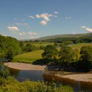
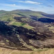
It has to be one of the most challenging and spectacular day walks in England and certainly one of the highest. At 27 miles and 10,200 feet, the full Beat the Bounds is not for the fainthearted.
Yet dozens of walkers – and runners – are expected to take on the challenge on July 6. It is a chance to claim at least 15 ‘Wainwrights’ from the Eastern and Far Eastern Fells in one go and to raise money for Patterdale’s school and church. At the same time participants will be following in the footsteps of those upheld an ancient tradition generations before them.
Centuries ago, before maps as we know them and certainly satellite navigation, parish boundaries had to be marked on foot, traditionally on Ascension Day or during Rogation week after Easter. With little in the way of written records to pass on to future generations, it was important that routes were preserved in the memories of younger citizens to be passed on.

Confirmation of parish boundaries was important to ensure the right to be buried within the churchyard and liability to contribute to the repair of the church was undisputed, as well as establishing common rights and the right to take tithes.
The priest of the parish, along with churchwardens and parochial officials, would therefore lead a crowd of local boys, armed with birch or willow stick markers, to beat the boundary and be witnesses to the route.
It was in this tradition that, in the 1980s, Patterdale parish residents Stephen Gorton and Ed Hill, together with the then rector of Patterdale, the Reverend Simon Crawley, walked the boundary in 13 hours. Stephen, who is 96 and has lived at Hartsop for 70 years, is a long-standing member of St Patrick’s Church and was the first recruit to the Patterdale Mountain Rescue Team by its founder Dr James Ogilvie.
In 1992 the friends invited other people to walk the boundary to raise money in sponsorship and donations for Patterdale Church of England School and the church.
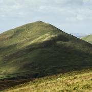
The route became an annual walk held on the first Saturday in July and following the parish boundary as much as was practically possible, taking in famous mountain names and ridges including Raise, Helvellyn, Dollywagon Pike, Fairfield, Kirkstone Pass, High Street and Place Fell as well as Angle Tarn.

A high-level companion to the Ullswater Way, Beat the Bounds has grown in popularity with fell runners too.
However, the pandemic lockdowns stopped the event in its tracks, then last year the closure of Kirkstone Pass meant it could not go ahead as planned. This year it has a new champion in Nicky Merrett, a Mountain Leader and owner of Hiking Highs.
Nicky, who lives 2km from Glenridding up towards Helvellyn, has taken it upon herself to revive and organise the 2024 challenge. Stephen was her father John Merrett’s oldest friend, her grandparents, Dulcie and Peter Merrett, ran Patterdale post office and a great grandfather George Herbert Johnson Baily was vicar at Patterdale from 1930-1938. “Helvellyn is really my playground,” she says.
Nicky became a qualified Nordic Walking instructor in 2015 and gained her Mountain Leader qualification in 2018. She, and her team of nine leaders, head navigation walks for corporate organisations in the fells offering “skills for hills” and deliberately choosing off-grid routes around Ullswater and in the Langdale, Borrowdale and Grisedale valleys.

“They leave their lives behind,” she explains. “It’s about exploring and learning new skills very much outside my clients’ comfort zones, they love it.”
Nicky is experienced in running group events. A fell runner as well as hiker, she took part in the Beat the Bounds last pre-Covid event in 2019, then completed it last year. “The weather was awful all the way round then at the top of Place Fell the clouds lifted. It was phenomenal, the colours electric, and I just decided that it was the best route I had ever run.
“Unfortunately, the event had died a death and I thought it was such a shame to let it go, so I volunteered to organise it. I was really adamant that it continue.”
“I had ambitions plans to create the Lake District’s first full weekend walking festival with navigation workshops and Fix the Fells sessions, a ceilidh at the end of the first day then recovery walks the following day with members of the Ullswater Way community taking people through heritage points of interest. That will all be for another year though, and this time we’re keeping it simple and just having the fundraising hikes and runs.”
As well as the Full Boundary, there is a Half Boundary of 12 miles and a Mini Beat of seven miles downhill for families and solo hikers.
Standards and expectations of such events have risen so it has been no small feat, involving setting up an official booking system with SiEntries, a Shap-based company that runs online entry and administration systems for hundreds of outdoor events nationwide.
Nicky is also investing in safety trackers for participants, who will be supplied with a map and route instructions. “The navigation makes this route a little different and rather fun for those keen on a map and compass. There will be a GPX route available for both halves of the high-level route.”

Mountain Leader colleagues will be positioned on the tops and VOOM Nutrition, based near Kendal, will be providing hydration and its Pocket Rocket bars at the feed point at Kirkstone Pass.
“Members of the community are making some nice goodies too and we will also have a first aid gazebo,” adds Nicky. St Patrick’s Church has organised insurance for the event.
“I would also like Andrea Taylforth, from Side Farm Campsite, and Can Hodgson, from Glencoyne Farm, for helping me identify who owns and farms the land along the route.”
“The school’s is appreciated to for sending letters to large landowners such as Dalemain, United Utilities, the National Trust, Lake District National Park and Rydal Estates, over whose land the challenge runs.
Hilary Barber has helped Nicky with research into the history of th
The Full Boundary starts at Patterdale School between 6am-9am, with the 3pm cut off at Kirkstone Pass. From Patterdale the parish boundary heads up from Glencoyne Farm on to Stybarrow Dodd. It skirts around the summit then on to Raise, White Side and Nethermost Pike, via Swirrel Edge and Striding Edge and on to Dollywaggon Pike.
From here it is “straight up the wall” of Seat Sandal – “it’s the worst ascent because you can’t see it,” says Nicky, “and we all know Fairfield is technical and rocky and it’s head down to the top.”
Hart Crag and Dove Crag follow, then Scandale Tarn, up onto Red Screes until walkers get the first view of Kirkstone Pass. St Raven’s Edge, Caudale Moor and the beacon at Thornthwaite Crag are passed before High Street, The Knott and towards Rest Dodd. “Before the summit it cuts to Satura Crag where the red deer hang out at dawn,” says Nicky.
The route then takes the ‘wrong’ side of Angle Tarn, over to Cat Crag, a little off trail, and on to Boredale Hause and Place Fell before descending via Hare Shore path, the last technical and tricky section, across the valley floor to the finish at the school.
The Half Boundary starts at the top of Kirkstone Pass and is a rolling start from 11am-3pm, and public transport is available from Patterdale to the start. The Mini Beat also starts at Kirkstone Pass, from noon, and is downhill is via Hartsop Hall. All the events finish back at Patterdale School.
Members of Stephen Gorton’s family have already signed up to take part. Stephen, whose favourite fell is Hartsop Dodd, which he looks out on every day, is happy the event has been revived. “It’s a good idea,” he says.
Nicky adds: “On a good day there are stupendous views throughout the length of the walk.
“We’re reviving something that’s been a fabulous event organised, first, by Stephen and his mates and it would be a real shame to let it go. It’s been part of the parish’s history and is about the parish, its people, the church and the school. And it also gives a lot of pleasure to other people who love Patterdale.”

THE BEATING OF THE BOUNDS
Today, a quick look at a 1:25,000 Pathfinder, Explorer or Outdoor Leisure series map reveals civil parish boundaries in England, making these maps one of the local historian's most valuable tools, says Angus Winchester, professor emeritus in the Department of History, at Lancaster University.
However, these modern maps have been at least 1,200 years in the making. They follow previous successive editions of the Ordnance Survey Six Inch and Twenty-five Inch maps that were surveyed between about 1845 and 1885.
The 19th century maps describe local administrative boundaries in great detail, Angus explains in his book Discovering Parish Boundaries (1st edn 1990; 2nd revised edn 2000; reprinted 2008 as a Shire Classic).
“Indeed the surveyors were charged with producing definitive maps, being required under the Ordnance Survey Act of 1841 to ascertain and map all public boundaries, drawing on local knowledge where boundaries had not been mapped before.
“The resulting maps delineated the whole spectrum of local administrative units functioning in the 19th century: counties, hundreds and wapentakes; boroughs and cities and their wards; parishes, townships and even divisions of townships. Each boundary was marked on the map as a dotted or pecked line, each section annotated to specify the exact line it followed.”
The published maps were the end result of a detailed process of local enquiry and pinned down boundaries that had, in many cases, never been mapped before, Angus explains.
The work of the Ordnance Survey also recorded place names, some of which provided evidence of boundaries, in particular stream names such as Merebrook and Merebeck, which are derived from the Old English maere, meaning ‘a boundary’.
“Before the mapping of the Six Inch Ordnance Survey sheets, boundaries were passed down by word of mouth and by ritual 'beating of the bounds', and disputes between neighbouring communities over the exact line of a boundary were frequent.”
Angus confirms that the 'beating of the bounds' was an age-old ritual of early summer, a common practice in the smaller parishes of lowland England but perhaps less so up in the fells.
He writes: “Local officials (the parson, if the bounds to be beaten were those of the parish; the constable of a township; the steward of the court of a manor) accompanied by a throng of inhabitants, young and old, perambulated the boundary.
“This communal occasion was often accompanied by liberal quantities of food and drink but it served a serious purpose, namely to keep fresh in the local memory boundaries which may never have been written down or plotted on a map. To serve that end, there arose the time-honoured custom of giving the young lads in the procession a memorable (usually unpleasant) experience at particular points along the boundary as an aid to memory. Examples of these rough rustic rituals are recorded across England in depositions made by witnesses during lawsuits over disputed boundaries.”
Angus includes an example from Lancashire, of tallow chandler Robert Fidler, who, aged 47 and giving evidence about the boundaries of Ormskirk in 1635, recalled how as a boy he “had his eares pulled and was set on his head upon a mearestone neere to a newe ditch on Ormiskirke Moore and had his head knocked to the said stone to the end to make him the better to remember that the same s t o n e was a boundary stone” (Lancashire Record Office, DDK/1601/3).
Angus adds: “Looking back at the process of boundary definition over the millennium or more, we can think of it as reflecting the gradually closer definition of rights as land came to be appropriated by individuals. The empty spaces between rural communities disappeared so that the territory of one abutted on that of its neighbours and a fixed boundary was born.”


![The beaver and kit spotted at Lowther [Lowther-Estate]](/resources/images/128x89/1x/18601737.jpg)
![The beaver and kit spotted at Lowther [Lowther-Estate]](/resources/images/180x180/1x/18601737.jpg)

![Julie Carter [Jessie Leong]](/resources/images/128x89/1x/18534684.jpg)
![Julie Carter [Jessie Leong]](/resources/images/180x180/1x/18534684.jpg)

