Nearly 134 miles in length, the Peak District Geo Walk is a long-distance circular route that takes the rambler through the Peak’s wonderful geology.
The guide at peakdistrictgeowalk.org explains how hard gritstone and softer limestone have shaped the landscape of our national park; check out their website for more in-depth explanation.
I’ve chosen the Ladybower and Upper Derwent reservoirs combined with the Derwent Edge section for this routed walk, one of the most sublime stretches on the long-distance Geo Walk.
I leave the route behind, however, to return the hiker to their starting point in a manageable day ramble of ten miles.
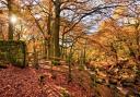
It’s a soul-restoring walk of water and moorland, the latter packed with atmospheric rocky outcrops with curious names like Lost Lad, Cakes of Bread and Salt Cellar.
1. Park up at Hurst Clough (free) on the road to Fairholmes. If it’s full, there’s additional parking at Fairholmes (fee). Drop down to the path that runs alongside the shore of Ladybower Reservoir and continue in the direction of Fairholmes.

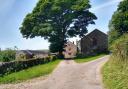
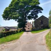
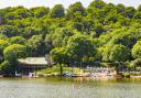
2. At Fairholmes, take time to explore the small information centre and fuel up with a drink and snack. From here, follow the path along the base of the Derwent Dam. After a period of heavy rain, I had the privilege of seeing water cascading over the dam head on my walk, the soaring wall of sandstone blocks an impressive sight.
Follow the road that curves round beneath the dam head, then take the path on your left to head north along the right bank of the reservoir (if the short cut heading up beside the dam wall is still closed because of tree felling). You’ll pass Derwent Dam again, this time from the top.
3. When you reach Walker’s Clough, take the path on the right that runs directly alongside this steep-sided valley. Follow the signed post to the left to continue climbing upward. At a crossroads of paths continue straight up, following the wall boundary. Take your time on this steep ascent to look back at the fine views of Upper Derwent and Ladybower Reservoir (and to catch your breath).
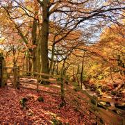
On sunny days the deep blue of the water complements the lush green of the conifer forests that fringe the reservoirs. Views of the Great Ridge with Lose Hill and Mam Tor start to appear along with the moorland plateaus of the Dark Peak.
After a while, the path flattens out as it veers right to follow another field boundary. The boggy land here is caused by peaty soils lying on top of impermeable shales of Namurian age (about 325 million years old).

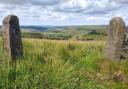
4. When you reach a gate, go through it and follow the signed fingerpost in the direction of Strines. The path, giving way to welcome slabs of York stone, climbs to Lost Lad, a 360° viewpoint and Ethel. The toposcope pinpoints the many much-loved peaks and plateaus of the Dark Peak.
The name Lost Lad refers to a young shepherd who lost his way in a blizzard when taking his sheep to safety. He was found curled up by the rocks the following spring, the words ‘lost lad’ scratched into the rock, story goes.
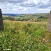
From here continue uphill to Back Tor and the second Ethel of the day. If you have the mobility, scramble up to the trigpoint and take in the extensive views of the Dark Peak, the conurbations and industrial sites of Yorkshire stretching out far beyond.

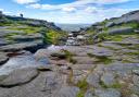
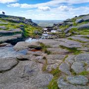
5. From Back Tor, continue along the slabbed pathway of Derwent Edge. You’ll pass many wonderful gritstone formations along the way: Cakes of Bread, Dovestone Tor, Salt Cellar, White Tor, Wheel Stones and Whinstone Lee Tor.
Originally the sands of ancient (Namurian) river deltas, buried and petrified, these monoliths are the result of continual weathering, sculpted over millennia by frost, wind and rain. Continue along the obvious path (with views increasingly opening out to Ladybower Reservoir) to what looks like a six-way junction of paths that lies beyond Whinstone Lee Tor.
6. Take the second path on your right (where the wooden post says ‘Walkers only, thank you’). It drops steeply down through a gully of loose stones (watch your step). Veer left to follow the track southward below Lead Hill. Continue on the path through pine woods towards Ashopton.
7. Go through the gate and turn right to follow the road past Ashopton Mill. It veers left to reach the A57.
8. Turn right to cross Ashopton Bridge, then right again to follow the reservoir bank back to your starting point.

COMPASS POINTS
DISTANCE: 9.4 miles
GRID REFERENCE: SK1870 8762
MAP: OS Leisure Map OL01 Peak District Dark Peak
DIFFICULTY: Moderate with a steep hike from the waterside pathway to Lost Lad and Back Tor.
REFRESHMENTS: The takeaway kiosk at Fairholmes with nearby picnic tables.