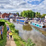
It’s not just dramatic waterfalls, picturesque reservoirs and flowing rivers here in Derbyshire. We take a look at some of our county’s picturesque and historic waterways and discover why they’re begging to be explored.

CHESTERFIELD CANAL
Length: 46 miles
Locks: 59 narrow, six wide
Renowned narrowboat enthusiast and star of the BBC’s Canal Boat Diaries Robbie Cummings has described the Chesterfield Canal as ‘one of the most beautiful canals in the whole of the system.’
High praise indeed for a stretch of waterway which runs from the River Trent right into the heart of Chesterfield, taking in parts of Nottinghamshire, South Yorkshire and, of course, Derbyshire along the way.
This is a particularly lovely and peaceful waterway from a scenery perspective, especially at its eastern end, with stretches taking in glorious, unspoiled countryside.
It is also well known for the variety of aquatic wildlife that thrives along its route, some of which – including linton’s pondweed and brackish water crowfoot – is considered rare.
Originally devised by the Derbyshire-born master canal engineer James Brindley in the 18th century, the line opened officially in 1777, five years after Brindley’s death.
The canal reached its zenith during the 19th century – notably providing the route for the transportation of 250,000 tons of stone used in the construction of the Houses of Parliament – but was on the wane by the early 20th century, superseded by the railways.
Decline inevitably followed, however the Chesterfield Canal Trust, a charitable company run entirely by volunteers, has been steadfast and determined to restore the network to its former glory for all to enjoy.
In 2017, the Trust received the Queen’s Award for Voluntary Service.
Since 1989, 12 miles of the canal has been restored, leaving less than nine left to be completed. The canal celebrates its 250th anniversary in 2027.
Did you know: You don’t need to be a narrow boat aficionado to enjoy this stretch of water. In fact, every single yard of the canal can be walked or cycled on the towpath known as the Cuckoo Way.

EREWASH CANAL
Length: 11.5 miles
Locks: 14
Completed in 1779, the Erewash Canal once connected coal mines in and around the Erewash Valley to the Loughborough Navigation, where goods would then be taken by road to Leicester and on elsewhere.
Its engineer, John Varley, was a close associate of the renowned engineer James Brindley, however the former was dismissed from his position when it emerged that he had miscalculated water levels, resulting in a rebuild of the top lock.
Beginning at Langley Mill and ending at Trent Lock, where the canal meets the Upper Trent in Nottinghamshire, the Erewash Canal once a hive of industrial activity – its waterway system used to transport all manner of goods from coal, quarry stone, brick and metal.
It’s now much quieter, of course, providing a mixture of woodland and grassland to explore, while the former mining villages that hug its route provide a glimpse as to its heritage and past.
To explore the Erewash Canal is to walk in the footsteps of one of Britain’s most celebrated literary figures, D.H. Lawrence, who took much inspiration from the countryside here which was so familiar to him.
Today, the canal is fortunately in good hands.
This May, a stretch of the towpath (between Potters Lock and Ashworth Road Bridge) was opened, designed to improve the route for both walkers and cyclists and give local people a green route to Ilkeston’s shops and businesses, while the Erewash Canal Preservation and Development Association, a charitable incorporated organisation, aims is to make the Erewash Canal a pleasant place to be for boaters and visitors alike.
Did you know: Despite being well past its industrial heyday, the Erewash Canal played an important role during the Second World War as it was used to transport bombshells from Stanton Iron Works.

PEAK FOREST CANAL
Length: 15 miles
Locks: 16
Described by the Canal & River Trust, the UK’s largest canal charity, as ‘one of Britain’s most scenic waterways’, the Peak Forest Canal benefits from sharing much of its route with the pretty River Goyt.
Running from Dukinfield Junction in Greater Manchester to Bugsworth Basin, the canal, engineered by the pioneering Alfreton-born Benjamin Outram, was opened in 1800 and originally served to transport limestone mined from the quarries of Derbyshire by boat to Manchester.
By the end of the 19th century Bugsworth Basin was handling over 600 tons of limestone every single day, as well as cotton, coal, grain and other manufactured goods.
This transportation continued along the canal’s waterways – albeit output had reduced – until 1959, although by this point Bugsworth Basin, close to the High Peak town of Whaley Bridge, had been closed for 33 years.
Bugsworth Basin began its restoration in 1968 having become derelict and, in 1977, was designated as a Scheduled Ancient Monument in recognition of its historical significance – one of two such sites part of the Peak Forest Canal network, the other being the grand three-arched Marple Aqueduct.
It was fully opened in 2005 following over three decades of hard work and determination by the Bugsworth Basin Heritage Trust, formerly known as The Inland Waterways Protection Society.
For all its rich heritage, the Peak Forest Canal quite simply, as the Canal & River Trust proudly state, runs ‘alongside the best parks and other public spaces in the country’ – including the Goytside Meadows nature reserve, home to a stunning array of wildflowers.
Did you know: In 2015, the Upper Peak Forest Canal and Marple Lock section was awarded a prestigious Green Flag in Keep Britain Tidy’s national award scheme – making it the first canal in England to achieve the feat.

TRENT AND MERSEY CANAL
Length: 93 miles
Locks: 76
Another canal engineered by Derbyshire’s James Brindley, the famed Trent and Mersey Canal was the country’s first truly long-distance canal network, taking in three counties – namely Derbyshire, Staffordshire and Cheshire.
Running from the River Trent at Derwent Mouth in Derbyshire, it continues all the way to Preston Brook in Cheshire, taking in some of South Derbyshire’s prettiest villages in the process – including Shardlow, Swarkestone, Weston-on-Trent, Stenson and many more besides.
Taking over a decade to complete, the route was designed to link the River Trent with the River Mersey and thus providing an inland route between the two major ports of Hull and Liverpool.
While plenty of evidence exist as to the canal’s industrial importance in the past, its route now is enjoyed by many for its peace and tranquillity, including stunning views for walkers and cyclists over the Cheshire Plains.
That said, many places on the route grew on the back of industrialisation and have the canal at least in part to thank, with the waterways playing a pivotal role in the development of both the Potteries and Burton on Trent being recognised as the country’s ‘brewing capital’.
These days, the Trent and Mersey Canal lends itself to leisure pursuits rather than commercial use.
In 1974, the Trent and Mersey Canal Society was formed to ‘promote the future well-being of the waterway and provide a focus for all who are interested in this time-honoured old canal – navigators, naturalists, businesses, farmers, residents and visitors alike.’
Did you know: Harecastle Tunnel is the Trent and Mersey Canal’s longest tunnel at around two miles in length, meaning it takes narrowboats around half an hour to enter and reemerge on the other side. The tunnel itself took 11 years to build.

CROMFORD CANAL
Length: 14.5 miles (before closure)
Locks: 14 (before closure)
Of course, not all canal waterways survive. In fact, many have been lost over the decades and centuries since such networks were integral to industrial Britain.
Yet some have successfully repurposed themselves, remaining relevant and of use for different reasons to the ones they were originally designed for.
Cromford Canal, which once connected to the Erewash Canal and Nottingham Canal, is a case in point.
Whereas once upon a time Cromford would have been the final destination for narrowboats on an unbroken route originating in Langley Mill some 14.5 miles away, much of the route now sits derelict, having been largely abandoned in 1944, 150 years after it had been completed under the guidance of William Jessop and Benjamin Outram.
Built in, as the Friends of Cromford Canal (FCC) evocatively describe, ‘a landscape which was in the process of being transformed from rural backwater to industrial heartland’, the top five miles of the Cromford Canal sits within the Derwent Valley Mills World Heritage Site.
There is much still to take in here that nods to Cromford Canal’s role in the area’s illustrious past but its equally loved now for being an idyllic place to walk, cycle and enjoy nature.
Due to its rich and varied wildlife – including threatened and declining species - the entire section of canal between Cromford and Ambergate (just over two miles) is a Site of Specific Scientific Interest (SSSI).
FCC meet twelve times a year to actively promote the canal and its restoration.
Did you know: At 1.6 miles long, Butterley Tunnel on the Cromford Canal was the third longest canal tunnel in the world when it opened in 1794. It closed to traffic in 1900 due to subsidence and was deemed ‘beyond economic repair’ in 1909.


