Regular followers of these walks will know I have a thirst for Dartmoor; I see it from my windows, it draws me in again and again. Cloud shadows race across its spaces; its grandeur is awesome in the true sense of the word. But these vast, open expanses, where mists may descend in a blink, can also seem a bit scary to those more comfortable with Devon’s hedged footpaths. Direction-finding on open moorland can be daunting for the uninitiated.
So, if you want the breathing space and cragginess of wide-open moorland, with the comfort of well-defined paths, this walk is for you. It’s rare to find a relatively ‘easy’ walk on Dartmoor, but as Princetown is the highest settlement on the moor there isn’t anything in the way of steep uphills – you’re already up there. That said, there is some ascent and clear weather conditions are vital. You will need to stay alert for landmarks.
There’s also much people-history around the area. The village is dominated by the granite edifice of its prison, built to house Napoleonic Prisoners of War in the early 19th century. The village was established as a result of the prison’s foundation and has an unusually suburban look for a Dartmoor settlement. The prison, which is owned by the Duchy of Cornwall, still houses low-category prisoners today and is home to a fascinating museum.
Princetown is a vibrant hub for outdoorsy types. Join them and make the most of some superb walking country.

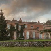
1. Start outside the National Park Visitor Centre. This elegant building has served many purposes ranging from officers’ accommodation in the early days of the prison, to a hotel. With an eye on the traffic, cross diagonally over the mini-roundabout and take the turning that isn’t signed to anywhere but runs between The Plume of Feathers and the Ramblers’ Rest.
Within a few metres the surfaced road bends right into a car park. Leave it and keep straight ahead on a stony path, soon passing through a blue-arrowed bridleway gate. This clear path is now our guide for almost two miles and to begin with rises gently. Look around: tors are visible near and far, often crowned by the weathered granite bones of the moor. Directly ahead is South Hessary Tor, three-quarters of a mile along the path. As you approach it, glance behind for a view across Princetown, with the radio and TV mast on North Hessary Tor towering above.
Many are tempted to climb South Hessary Tor. If you do, watch your step – you’ve still a few miles to go.
Continue beyond the tor. One of Dartmoor’s historic drystone walls flanks the path to the left but it doesn’t get in the way of the views. These walls, whose construction is one of our heritage skills, can be good wildlife habitats, providing a range of microclimates, with hidden nooks offering shelter to creatures and the rocks themselves allowing plants to establish. They also serve as wildlife ‘corridors’ across the landscape.

2. Half a mile from South Hessary this wall veers left, at which point there stands a stout granite boundary stone. Look carefully: the inscription ‘PCWW 1917’ can be made out. This stone was installed by Plymouth Corporation Waterworks and is one of many that marks the 17-mile boundary of the catchment for Burrator Reservoir. Although the reservoir was originally completed in 1898, the Corporation only acquired the catchment land in 1917, subsequently installing these markers.
Continue along the track, looking out for – and counting – further PCWW boundary stones. You may also spot other artefacts, such as horizontal granite posts with holes – evidence of a former gatepost. When you reach the fourth PCWW stone, half-a-mile from the first stone we mentioned and about 300m from the third, there is a clear crossing track. Turn left here to reach a small parking area by the road in 200m. Disappointingly, the brightly coloured vehicle I could see from a long way off proved not to be an ice-cream van.

3. Cross the road and join the ongoing bridleway immediately opposite, now a narrower peaty path. In just over 100m this path arrives at a broad stony track. Keep straight ahead along it, with a drystone wall to the left.
If you’re tall enough you will glimpse a semi-derelict cottage over the wall, a forlorn place that tells of lives gone by. The track passes through a gate and continues downhill, passing the gate for Peat Cot Cottage on the left and going through the gate ahead, signed Peat Cot Farm. Immediately after this gate is an old Wesleyan chapel on the left, which held its last service in October 1983. After this its lease was surrendered to the Duchy of Cornwall, one of the major landowners on the moor.

4. Beyond the chapel follow the track down to the fingerpost a few metres away. For humans (rather than horses) the path follows the bank beside delightful Devonport Leat (water to your right), built in the 1790s to carry fresh water to Devonport. It can be rough underfoot along the bank – don’t trip and fall in. If you find it too ankle-turning, then the bridleway runs through the field just below the bank.
But the waterside is a lovely stretch of walking and attracts the flying jewels that are Demoiselle damselflies. This is where we chose to dig out the sandwiches. A mighty splash alerted us to a dog in the leat. ‘Watch the sandwiches!’, we said, as we looked round for an opportunistic canine… but the horned head bobbing in the water was that of a small ewe who had overreached, fallen in and was swimming. She reached the far side but the banks were too steep for her to scramble out. We summoned assistance from the friendly chap at Peat Cot Farm and the little ewe was rescued, trotting off to dry out in the sun. We passed the time of day, finished the picnic and resumed the walk.
The leat-side path reaches a stile. Cross this and go left down the slightly awkward, rough-hewn steps into the field. Walk away from the leat, following the stone wall on the left. This soon passes a fingerpost by a gate, where those who were walking through the field join us.

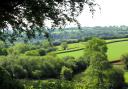
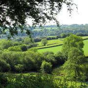
5. The walk now follows this wall across the moorland. Keep it to your left as it disappears into the distance. There will be times when you have to weave about to avoid mushy areas, though a wooden plank bridge carries the path over a busily rushing stream that soon becomes Strane River. Initially this path will go gently downhill but starts to climb again after the footbridge. As you climb, glance over your left shoulder for a good view back to Peat Cot.
A mile from the leat, the path passes through a gate. Continue ahead towards the buildings of Bullpark. Very soon a broad track comes down from the right; keep ahead as it joins – and we are now walking along the High Moor Link of the Dartmoor Way, a recently established long-distance path that circumnavigates the moor, with this link crossing the moor and connecting Buckfastleigh and Tavistock.

6. Go through another gate and follow the surfaced drive past the buildings of Bullpark. At the end of their garden fence a two-way fingerpost directs right, signed for Bachelor’s Hall. Follow this, through a gate and across a stream, with another babbling through the trees to your right. The track bends left and goes through a gate by a conifer copse, after which it curves right and the roof of Bachelor’s Hall is obvious, down to the right. This 16th century former farm was, later, a youth hostel, and is now a place for residential get-togethers for large groups.
Within 100m of the conifers you reach a three-way fingerpost. Turn left. The track rises, crosses a leat and goes through another gate about 100m from the fingerpost. Continue uphill on the track, heading towards an area shown on the map as, rather bizarrely, New London. Apparently, houses hereabouts were designed and constructed by operatives from the metropolis.
The track continues uphill for a while and as it levels out Princetown and its church tower appear. After another gate there is a very good view across to the prison.
The track starts to descend and soon bends right, then left and ambles down to the road, passing intriguing remnants of machinery. These, I’ve been told, were either connected to timber transport or may have been the gates of a level crossing... If anyone knows for certain...
At the road turn left – be careful as there’s no pavement for a short stretch. Look out for the Hooker Fountain as you head back to the village, erected in 1908 in thanks for the ‘life-giving air of Princetown’. You soon find yourself back at the Visitor Centre.

Compass points:
Start point: National Park Visitor Centre, Princetown. Postcode: PL20 6QF; grid ref: SX590734
Parking: Clearly signed, round the corner from the Visitor Centre
Map: OS Explorer OL 28 Dartmoor, 1:25 000 (this scale shows greater detail than the map printed here)
Distance: Nearly 6 miles
Terrain: Open moorland, tracks, leat-side path, roads in Princetown. Rough underfoot at times and squelchy in places
Important note: The walk crosses open moorland so clear conditions are necessary
Exertion: Easy-moderate: no very steep inclines but some clambering
Dog data: Many animals grazing; roads in Princetown at start and finish
Refreshments: A variety of cafés and pubs in Princetown. See also '4 things to do’
Toilets: In car park
Public transport: Buses serve the village
4 things to do while you’re in the area
Dartmoor National Park Visitor Centre: go inside to learn about its history, to enjoy the many exhibitions and displays and to buy books and maps
The Prison Museum offers a fascinating insight into life on the inside and the history of this iconic prison. Porridge isn’t served.
The Warren House Inn is just over 7 miles away and, at 1,425ft, is the highest pub on the moor. Enjoy food and drink in an historic location with superb views across the moor from its outside tables. The open fire has been alight since 1845.
Widecombe-in-the-Moor is an appealing village, just over 10 miles away, whose lofty church tower earns it the nickname of the ‘Cathedral’ of the Moor
In the July issue we head for Beaford