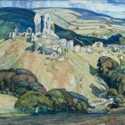
Powerstock Castle’s motte (mound) and bailey (outermost court) were created in the late 11th or 12th century, but the banks, ramparts and ditches enclosing the privately owned nine-acre site are thought to be earlier. King John acquired the land in 1205 and built the castle, which he used as a hunting lodge, last visiting in 1213. The castle was granted to Sir Ralph de Gorges in 1266 but he rarely visited it, and it fell into disrepair becoming a ‘quarry’, its stonework being incorporated into the houses of Powerstock.
St Mary’s the Virgin Church was built in the mid-12th century, extended in the 14th century, and the tower was heightened in the 15th century. St Mary’s was restored, and the chancel rebuilt in 1859. Thomas Sanctuary, the local vicar, built a village school in 1848. He replaced it with a new school in 1876 which is now the village hall.

Mappercombe Manor, barely a mile from the start of this walk, mostly dates from the 16th and 17th centuries whilst part of the front block dates from the 15th century. The thatched stone outbuilding which we pass close by are from the late 17th century, as are the garden’s twin gate-piers with ball-terminals.
Several streams run down from surrounding hills into the Mangerton River which flows through Powerstock, this joins the River Brit which meanders down to the harbour at West Bay. Also terminating at West Bay was the 1879 extension to Somerset and Dorset Railway’s Maiden Newton to Bridport line which had opened 20 years earlier. We cross this former railway line twice, south of Mappercombe Manor on the outward section, and north of Uploders on the return.
The Walk
1. From St Mary’s, walk down rather steep School Hill, past the right Primary School and Bridge House where a signed footpath goes right before Mangerton River bridge. Continue past a left signed footpath and up around bends to the three-way lanes’ junction. Go straight across into the unsigned sunken stony path rising between trees, then between hedges to a T-junction of tracks. Turn left and instantly right through the un-arrowed (but footpath) hedge-gap into the field corner. Follow the green track against the right hedge with Eggardon Hill-fort far left. Through into the next field, continue along the hedge to the road. Signed ‘Footpath’, cross into the opposite farmyard and go straight through to the facing sunken tree-lined track.
2. Walk straight down and past left Mappercombe Manor house and gardens. Past the manor’s left open-fronted barn, fork left down to the footpath-gate - ignoring the more obvious green track going straight ahead. Through into the steep field’s corner, walk straight down to the bottom hedge’s footpath-gate. Go through and walk straight across the field, aiming towards the electricity pylon with wooded Shipton Hill to its right. Descend to the bottom hedge’s facing gap. Go through and follow the field’s green track with the left hedge, then enclosed up to the left footpath-post and the former Somerset and Dorset Railway track. Cross over, pass the left footpath-post and continue along the field’s stony track with the left hedge. Rising, glimpse Eggardon Hill from the top left footpath-gap, then descend to the fence’s gate/stile. Over, go ¾-right across the field corner to the hedge’s similar gate/stile. Over, take the instant-right footpath-arrowed gate and follow the right hedge’s level path with the stream in the right hedged field, then along the meandering right-fenced trees.

3. Finally, swinging right past the footpath-arrowed electricity post, merge with the bridleway to the bridleway/footpath corner gate. Through, turn left through the picket-gate onto the footpath through trees and over the stream footbridge. Continue up past the left cottage to emerge into Uploders, opposite ‘Maie Cottage’. Turn right for The Crown Inn, beyond the phone box. Otherwise, turn left and stroll through the village with mostly stone cottages, many thatched. Around the right/left bend with the left stone barn, continue along the tree-edged lane past left Uploders House’s long wall. Then, with trees left, pass right Locks Hill and the bridleway pointer, and Upton Manor’s landscaped gardens below left. Out past ‘Uploders’ sign, keep straight on, passing left Upton Manor Farmhouse drive. Continue past the left bridleway-signed ’Old Piggeries’ track and the elegant right thatched house.

4. Keep straight on past left Matravers House until you reach a right bend. Here, turn left at Sunrise Farm onto the bridleway signed ‘No Through Road’. Pass left Matravers Farmhouse, right Matravers Stables and left Matravers Cottage. Over the stream bridge, walk up the concrete track, around the cantilever-gate and up to the crossing with Collins Nets factory facing. Turn right onto the rising track, passing the nearby-right bridleway-arrowed gate, more open now between fields with fine views of the hills surrounding Uploders. Looking back, see Shipton Hill again. Under two rows of electricity cables, the second with pylons, continue along the track with narrow field/wide verge left. Between Gas Pipeline posts, see Mappercombe Manor forward-left across open fields. After ascending slowly past a right wood with fine views left, keep meandering to the Somerset and Dorset Railway track.

5. Cross over and go through the bridleway-posted hedge-gap. Turn ¾-right on the long field’s hoof-printed path aiming for the hedge-enclosed track which starts from the bottom hedge. Join and follow this rutted, sunken rising track. At the top, pass a left bridleway-signed track and continue up to join the clearer track from your right. Walk up this hedged, banked track to the crossing with a left corner farm. Cross and descend into Nettlecombe. At the lanes’ junction with the facing thatched cottage, take the right No Through Road, signed ‘Post Office Closed 1999’. Past the left row of cottages and left footpath, continue down past right Packhorse Cottage, steeply and hedged, to the old stone-flagged packhorse bridge and stream-ford. Across, fork left past the right thatched cottage, signed ‘Bridleway Powerstock ½’.

6. Then, go over the left footbridge and follow the narrow path above the left stream. Pass right ‘King John’s Path’ and, losing the stream left, pass a left stile and ascend the sunken path with right trees on Powerstock Castle’s steep bank. Near the top, pass the right gate which opens onto an ancient entrance through the castle’s banks and ditches (privately owned). Descend the deep dark hollow way, worn by centuries of traffic to and from the castle. Down to King’s Lane, turn left with banked trees left and stream and field right. Past the cottage right and left Rabbit Catcher’s Farm gate, cross the stream and start ascending steeply. Past the left ‘Nettlecombe ¼’ footpath-sign and right Queen Elizabeth’s 2006 bench, continue around the bend to the Three Horseshoes Inn in Dugberry Hill and back to St Mary’s where you started.
Compass Points
Distance: 4½ miles/7.25 km
Time: 3½ hours
Exertion: Not strenuous. Any ascents are gradual
Start: St Mary the Virgin Church, Powerstock. Park alongside high churchyard wall on the ‘Eggardon Hill’ sign-posted road (Grid Ref: SY017962)
Map: OS Landranger Sheet 194
Public Transport: None
Dogs: On leads in fields with livestock and on roads. Follow The Countryside Code
Refreshments: Three Horseshoes, Powerstock and The Crown, Uploders. Both, book in advance for meals and closed Mondays.
PQ
‘King John built the castle, which he used as a hunting lodge, last visiting in 1213’
‘Several streams run down from surrounding hills into the Mangerton River which flows through Powerstock’


