The starting point for this circular walk, taking in mixed deciduous and pine woodland, verdant river plains and protected heathland, is from Wareham’s St Martin’s-on-the-Wall Church. The Walls, Wareham’s massive earthen banks, are believed to have been built by the Anglo-Saxons during King Alfred’s reign as protection against the Viking raids of 876. St Martin’s was built beside the town’s north gate, strengthening its defenses and attracting offerings from travellers. Probably founded by St Aldhelm in the 7th century, St Martin’s is Dorset’s most complete late-Saxon church. The original building was destroyed by the Vikings around 1015 and rebuilt when King Cnut converted to Christianity a few years later. The present building’s east chancel and north and south walls of the narrow 30ft nave are of that date. Over the following centuries, the church gradually fell upon hard times – by 1736 it was only used for marriages and christenings. It remained neglected for around 200 years, until the building was restored and re-dedicated in 1935-36.

The Walk
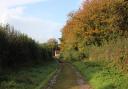
1. From the church, walk down North Street hill to left Shatters Hill with Mount Pleasant and the former Nelson Inn opposite. Walk up Shatters Hill to left Mill Lane. Opposite, take the right ‘Two Rivers Walk’ signed drive, down past the footpath-arrow and ‘Private Drive’. Down to 12th-century North Mill, go over the brick-parapet bridge and through the gate onto Wareham Common, the River Piddle’s verdant flood-plain. Turn left alongside the river, over another brick parapet bridge and then follow the used path alongside the right bank of the meandering, deep and calm River Piddle. Enjoying the wide-open spaces, continue to Wareham bypass underpass. Go through on the elevated concrete walkway. Out the other side, keep following the river, the path less clear, to 1½ gates onto West Mills track, where Wareham Forest Way joins us.

2. Keep to the track, passing the Baggs Mill River Flow Recorder shed, to the railway bridge. Under this, at the multi-arrowed post which includes Wareham Forest Way (WFW), follow the track across the flood plain to the hedge-gate or nearby St Edward’s Way (SEW) footbridge. Through or over, follow the curving track towards farm buildings, passing a left hedge footpath-bridge just before the right white barn. Continue past the barn to the facing WFW and footpath-gate. Through, cross to the next gate. Through into the yard, turn left up to another gate. Through, follow the footpath-arrowed grass banked and hedged path. Far left, see Creech Barrow Hill on the distant horizon. Passing the left WFW/SEW footpath post, continue to the facing gate into Carey Wood. Don’t go through, turn right up past the left building and continue to another multi-arrowed post.

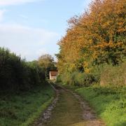
3. Keep straight on to the footpath-signed exit with more arrows and meeting drives from left cottages and Carey House. Keep straight on, wooded both sides, to the gate onto Carey Road. Cross into the WFW and footpath-signed track with the left cottage. Continue, with deciduous trees on both sides and gravel pits behind the right trees, up into Carey Heath and under pylon cables. Then, level again, with more pine trees, pass a right fork. Continue with laurels left up to the signposted crossing. WFW and SEW go left here. But take the right footpath. Continue to the angled footpath crossing and go left. Walk to the footpath-back signpost on the Bere Regis road. Cross over into Wareham Forest car park. Wareham Forest is gradually being restored from a pinewood timber forest to native woodland and heathland. Walk straight on around the cantilever gate on the main forest track into the forest. Through the next gate, with two right turnings, keep straight on along the purple-arrowed track. Stay on the main track with the parallel right path, ignore side turnings.

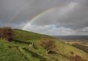
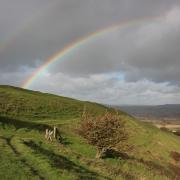
4. Ascend gently to a purple-arrowed left bend. Turn left down the steep track - but first, go straight on to the dead-end viewpoint for an overview of Morden Bog Nature Reserve and Decoy Heath ‘tundra’ landscape below. Down the steep track to the T-junction, go right and walk to the fork with the left purple-arrow. Go right, across the left-fenced scrub and heath to a three-way fork. Take the middle sandy track, not purple-arrowed now, elevated above Northport Heath. Meandering around several right and left bends, mostly with pines right and heath left, eventually the track bends right and ascends through birch and pines with the golf course outside left. Over and down to a fork junction with right blue-arrow, go through the left 1½ and cantilever gates out of Wareham Forest and onto a tree-lined path between golf greens. Across a golfers’ path, continue along the fenced track down past electricity stanchions to join a Tarmac track between houses.

5. At the blue walkers’ signpost at Northmoor Way, cross into Burns Road with a stream below right. Go through the fence-gap into Northmoor Park. Walk through past the right play area, out onto the Tarmac path and straight into Tantinoby Road. At the T-junction with Northmoor Way again, cross into the woodland path to Carey Road with the left roundabout. Cross on the refuge and go left to the gated railway crossing. If closed, use the footbridge overlooking Wareham Station. Over, walk past the former Railway Hotel left. Past the right houses, peel off right onto the shared pedestrian/cyclist track to Wareham By-pass underpass. Through to the other side, continue up the road with Wareham Common’s flood plain and River Piddle right. Over North Bridge, widened in 1846, and with rounded arches built in the 1670s, continue up to St Martin’s Church where you started.
Compass Points
Distance: 5 miles/8 km
Time: 3 hours
Exertion: Not strenuous, any ascents are gentle. River plains are flat.
Start: St Martin’s Church, North Street (Grid Ref: SY923877). Parking: Streche Road by Town Walls off West Street (Long Stay), or Howard’s Lane (Max. 4 hours)
Map: OS Landranger Sheet 195
Public Transport: First CoastlinX53, Morebus 40
Dogs: On leads on roads and when requested, abide by The Countryside Code
Refreshments: Wareham is awash with excellent pubs, tea rooms and coffee shops
PQ
'The original building was destroyed by the Vikings around 1015 and rebuilt when King Cnut converted to Christianity'