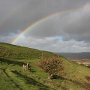
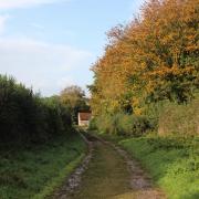
The medieval road from Bridport to Axminster ran through Symondsbury then round north of Colmer’s Hill to Quarry Cross and North Chideock and on to Whitchurch Canonicorum. Ronald Good, in his 1940 publication The Old Roads of Dorset, describes the route as ‘one of the finest and most impressive old roads in this part of Dorset, being deeply sunken in places, and with the old metalling (road surface) to be seen here and there’. Following Shutes Lane and Hell Lane, this will be our holloway route as far as North Chideock. We then visit Chideock itself before circling round over Quarry Hill back to Symondsbury. In Highways and Byways in Dorset (1906), Sir Frederick Treves writes: ‘Symondsbury is a pretty enough village of thatched cottages and many trees’ whilst ‘Chideock is an unspoiled old-world village in a hollow of green fields. Most of its cottages are ancient and are still made beautiful by thatched roofs’. In many ways little has changed, though with the A35 cutting through Chideock it is marginally busier.

The Walk
1. From the triangle with the huge beech, take the unsigned road with the low dry-stone wall and church on the right. This is Shutes Lane. Walk up past, left Shutes Farm, right Shutes House and left thatched-porch cottages. Continue up into the sunken, shaded ‘Public Route to Public Footpath’ track, still Shutes Lane although closed to traffic for the foreseeable future. Rising slowly, the track floor becomes partially cobbled (metalled). Emerging, blinking, into the sunlight, the Symondsbury Estate path crosses your track with the left gate opening to Colmer’s Hill. Keep straight on and, at a footpath-signed right-fork, keep left, again signed ‘Public Route to Public Footpath’. Follow this track, meandering around lower Colmer’s Hill, then rising slowly, darker and sunken into daylight again before continuing, on reducing track, past a right thatched cottage drive.
2. Continue up shady, sunken, Shutes Lane into the ever-deeper and darker ‘canyon’ of high landslip-prone, tree-topped sandstone walls with ancient, and modern, graffiti. This is also known as a holloway. Continue then climb out to meet a track coming from a left field gate. Keep on up to nearby Quarry Cross tracks’ crossing, with green arrows post on your right, pointing left or straight on. On your hairpin left, the gate at the track’s end overlooks Quarry Hill. This is your return route. But go left, following the green arrow’s direction, into the real Hell Lane, another ancient hollow way. Narrow and darker, Hell Lane has been rutted by off-road vehicles, hence its closure to all traffic. Soon becoming greener and, briefly into the light, a gated track crosses with Quarry Hill over the left gate. Continue down, shady and damp again for ½ mile, then the track shares the stream bed and passes a left barnyard. Finally, past a right footpath-gate, the right ‘Hell Lane Annexe’ cottage is where Hell Lane becomes the road into North Chideock. Before the cottage, go over the left footpath-signed stile.

3. Walk straight up the steep field on the used path to the top corner footpath half-gate in trees. Through into the field corner, see Thorncombe Beacon and Doghouse Hill very far left. Follow the field’s green track along the right wood, which hides Chideock Manor and grounds, seeing Chideock’s church and the sea ahead. Past the backward-pointing footpath signpost, join Chideock Manor’s drive with Chideock forward-left. Meander down the sunken, shady drive/track under big old trees, over River Winniford bridge and up to the left corner house. Onto the road, North Road, turn left and walk down past right 18th-century thatched Gate Farm cottage. Joining the left pavement, pass right and left ‘Closes’, then pass the left Catholic chapel and cemetery. Emerge onto Chideock’s A35 at left 14th-century St Giles’ Church with its 15th-century tower.

4. Turn left down the A35. Pass the right ‘Seatown’ lane, left ‘The Castle’ stone-mullioned 17th-century house, Chideock House, and Bridge Cottage at River Winniford’s Chideock Bridge. Keep walking east past elevated thatched cottage gardens. Left Ruins Lane leads to earthwork remains of Chideock Castle which, having changed hands four times during the Civil War, was ‘slighted’ in 1645 by Colonel Ceely, the commandant of Lyme. Continue past The George Inn. When the pavement ends, take the left footpath-signed track up to the farm-gate/stile. Over onto the concrete track T-junction, turn right up between fields, with Quarry Hill ahead-right. Through/over the footpath gate/stile, walk up the track past the left barn and bend left at the footpath-post. Continue above the barn and sheltering trees to the fence-gate and footpath-stile.
5. Over, follow the green track up the shallow valley floor with woods right, occasionally looking back to see the sea, south, and Langdon Hill (which hides Golden Cap) west. At the top of this huge field, ignore the gate. Instead, go over the footpath-stile, cross the enclosed grass track. Over the opposite footpath-stile, walk up the field to the fence’s footpath gate/stile. Over, notice two woods, one ahead and one to your right, both on the edge of Quarry Hill itself. Walk half-left up to pass left of the wood. Below it, see Chideock Manor which was shielded from view on your way into Chideock. Follow the rough and narrow path curving right around the hillside below the wood to the fence’s un-arrowed stile. Over, go down steps under trees to the next footpath-stile.
6. Over, cross the valley head on the straight path, passing a right footpath-post and swinging clockwise to meet the field’s left hedge and the corner footpath-gate, through which you may have looked before going down Hell Lane. Through, go down to Quarry Cross junction with the green arrows. Double-back right into Shutes Lane and, deviating neither to left nor right, follow your outward path down below Colmer’s Hill to St John the Baptist’s Church where you started.
Compass Points
Distance: 4¾ miles/7.5 km
Time: 3½ hours
Map: OS Landranger Sheet 193
Exertion: Not too strenuous. Ascents are gradual. Waterproof footwear may be needed for combined path/stream where Hell Lane enters North Chideock
Start: St John the Baptist Church, Symondsbury (Grid Ref: SY445936)
Public Transport: None
Dogs: On leads in fields with livestock (lots of sheep) and on roads. Follow The Countryside Code
Refreshments: Dog friendly Symondsbury Kitchen for home cooked food from the estate


