Situated between Blandford and Wimborne, Tarrant Rushton airfield on Abbeycroft Down was constructed in preparation for the planned invasion of Europe. Opened in October 1943, it was a ‘Class A’ airfield with three intersecting runways. The main north-south runway was 5,900ft (1815m) long.
![RAF Halifaxes and gliders at Tarrant Rushton airfield on D-Day 1944.]() RAF Halifaxes and gliders at Tarrant Rushton airfield on D-Day 1944. (Image: Andrew Wright Collection)) The major users were 298 and 644 Squadron Glider Pilot Regiment which used Halifax aircraft as tugs for huge Horsa and Hamilcar gliders carrying troops and tanks. On D-Day 6 June 1944, 298 and 644 Squadron captured Pegasus Bridge, and flew further supply missions the same day. SAS and SOE operations and tactical bombing missions flew from here during October and November to Holland and Norway. When the airfield passed back into agricultural use in 1980, the two cross-field runways were removed but the north-south runway remains as a farm track.
RAF Halifaxes and gliders at Tarrant Rushton airfield on D-Day 1944. (Image: Andrew Wright Collection)) The major users were 298 and 644 Squadron Glider Pilot Regiment which used Halifax aircraft as tugs for huge Horsa and Hamilcar gliders carrying troops and tanks. On D-Day 6 June 1944, 298 and 644 Squadron captured Pegasus Bridge, and flew further supply missions the same day. SAS and SOE operations and tactical bombing missions flew from here during October and November to Holland and Norway. When the airfield passed back into agricultural use in 1980, the two cross-field runways were removed but the north-south runway remains as a farm track.
At Hemsworth Farm, the listed flint and brick walled 16th-century Hemsworth House is hidden by a high walled garden, however the elegant south-east front can be seen across fields on this walk. A new wing was added in the 18th century, the front was remodeled in the 19th century.
![Hanger by the entrance gate.]() Hanger by the entrance gate. (Image: Edward Griffiths) The Walk
Hanger by the entrance gate. (Image: Edward Griffiths) The Walk
1. Go through the double-gates or footpath-signed kissing gate into the airfield. Walk past the left black hangar to the left tree clump opposite the three-way footpath and bridleway sign. Turn left. Follow the asphalt and concrete taxi-track with left fence and right field. Past a wide left concrete area, keep straight on and meet the right hedge. When the hedge ends, pass the left bridleway-signed path before the two left gates and fence. Continue up the taxi-track with fine fields and scattered woods views. Swinging right, more hangars come into view ahead. Now take the left bridleway-signed track. Through 2½ ‘Conservation Area’ gates, follow the track, fenced both sides, swinging left and becoming concreted between fields.
![Agriculture has returned to these once busy wartime airfields.]() Agriculture has returned to these once busy wartime airfields. (Image: Edward Griffiths) 2. Continue then bend right with a long wood left and pass the left silage storing area. Becoming a farm track, go through the facing gate and continue along the left wood. Past a right barn and yard with crossing tracks, keep straight on with left hedge and right fenced field. Badbury Rings appear forward-right. Around bends, pass right tracks and trees, continue past left barn and a weather-boarded brick house. Keep straight on with trees left and right and several gates into right and left fields. Now hedged again, continue past a hedged right house and around the left and right fenced bend. Coming into Hemsworth Farm, continue past left barns and Hemsworth House right behind its high-walled garden. Now, continue past the right house drive and bend left/right off the ‘fork’ to pass a barnyard right. Continue past the brick barn with two dormers and swing right, joining the track coming from your left.
Agriculture has returned to these once busy wartime airfields. (Image: Edward Griffiths) 2. Continue then bend right with a long wood left and pass the left silage storing area. Becoming a farm track, go through the facing gate and continue along the left wood. Past a right barn and yard with crossing tracks, keep straight on with left hedge and right fenced field. Badbury Rings appear forward-right. Around bends, pass right tracks and trees, continue past left barn and a weather-boarded brick house. Keep straight on with trees left and right and several gates into right and left fields. Now hedged again, continue past a hedged right house and around the left and right fenced bend. Coming into Hemsworth Farm, continue past left barns and Hemsworth House right behind its high-walled garden. Now, continue past the right house drive and bend left/right off the ‘fork’ to pass a barnyard right. Continue past the brick barn with two dormers and swing right, joining the track coming from your left.
![Glimpse of Hemsworth House from the grass track.]() Glimpse of Hemsworth House from the grass track. (Image: Edward Griffiths) 3. At the left grey barn’s corner with a bridleway-arrow post, bear half-left across the yard. Go through facing 1½ footpath and bridleway gates and follow the track with right hedge and left fenced field. Ignoring any sidetracks/gates, continue to the facing bridleway-gate. Through, continue between the left pine-wood and right field. Reaching the bridleway T-junction, with trees on both corners, turn right. Left along the pinewood leads to a bridleway junction with the Roman Ackling Dyke on its way from Durnovaria (Dorchester) to Old Sarum (Salisbury). However, having turned right, follow the fence-enclosed grass track between fields slowly upwards with King Down Wood and Badbury Rings left. View of Hemsworth House is clear beyond the trees left.
Glimpse of Hemsworth House from the grass track. (Image: Edward Griffiths) 3. At the left grey barn’s corner with a bridleway-arrow post, bear half-left across the yard. Go through facing 1½ footpath and bridleway gates and follow the track with right hedge and left fenced field. Ignoring any sidetracks/gates, continue to the facing bridleway-gate. Through, continue between the left pine-wood and right field. Reaching the bridleway T-junction, with trees on both corners, turn right. Left along the pinewood leads to a bridleway junction with the Roman Ackling Dyke on its way from Durnovaria (Dorchester) to Old Sarum (Salisbury). However, having turned right, follow the fence-enclosed grass track between fields slowly upwards with King Down Wood and Badbury Rings left. View of Hemsworth House is clear beyond the trees left.
4. Then forward-left, notice an airfield hangar. Continue, now with right hedge to a two-way bridleway-posted junction with field gates all around. Keep straight on, hedged both sides, to arrive at a clearing with right open-barn and gated cattle-pen. Through the facing gate, continue along the hedged track. In ¼ mile, reach a gates/tracks junction with open field right and Badbury Rings much closer left. Keep straight on, hedge left, fence right, now on green track/path with barns (your target) on the forward-right horizon. In another ¼ mile, go through end 1½ gates with a left green track. Go straight on, around a bridleway cantilever-gate, and ascend slowly along the left wood’s edge with open field right. Suddenly, the path becomes airfield concrete, and, in a few yards, it meets a concrete track emerging from the left ‘Private’ wood.
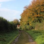
![Track rising to airfield from 'Private' wood.]() Track rising to airfield from 'Private' wood. (Image: Edward Griffiths) 5. Turn right up the concrete track between open fields. At the right barns you’ve been aiming at, meet a three-way bridleway-signed T-junction. Go right and instantly left on the wide concrete airfield taxi-track, away from the right barns. Pass the first right asphalt fork and the next bridleway-signed asphalt track. The concrete is very wide here, being the approach area at the south end of the airfield’s main north-south runway which remains now as the right ‘Private’ track. To complete the circuit of the perimeter taxi-track and to enjoy the ever-increasing views as the airfield gently rises northwards, swing slowly right then keep straight on. Pass left Preston Farmhouse and buildings, and the left bridleway-track which leads down to the Tarrant Valley road.
Track rising to airfield from 'Private' wood. (Image: Edward Griffiths) 5. Turn right up the concrete track between open fields. At the right barns you’ve been aiming at, meet a three-way bridleway-signed T-junction. Go right and instantly left on the wide concrete airfield taxi-track, away from the right barns. Pass the first right asphalt fork and the next bridleway-signed asphalt track. The concrete is very wide here, being the approach area at the south end of the airfield’s main north-south runway which remains now as the right ‘Private’ track. To complete the circuit of the perimeter taxi-track and to enjoy the ever-increasing views as the airfield gently rises northwards, swing slowly right then keep straight on. Pass left Preston Farmhouse and buildings, and the left bridleway-track which leads down to the Tarrant Valley road.
![South end of the north-south main runway.]() South end of the north-south main runway. (Image: Edward Griffiths) 6. Continue, all fenced left and open right, to the long right wood with a bench offering fine views. Continue to the wood’s north end and zig-zag left-right on the concrete, passing the green footpath-signed track down into Tarrant Rushton. Past some horse chestnuts, notice the views to Ashley Wood Golf Course and the communications mast at Blandford Camp. Continue around right curves and past a left iron-fenced area bordered with trees, then between open fields again with Win Green copse due north in Wiltshire. Past the north-south runway’s north end, now farm track, keep swinging right, slightly descending now. After the left track from a gated field, pass another left clump and another bench, and turn left at the bridleway-signpost back to the exit gates where you started.
South end of the north-south main runway. (Image: Edward Griffiths) 6. Continue, all fenced left and open right, to the long right wood with a bench offering fine views. Continue to the wood’s north end and zig-zag left-right on the concrete, passing the green footpath-signed track down into Tarrant Rushton. Past some horse chestnuts, notice the views to Ashley Wood Golf Course and the communications mast at Blandford Camp. Continue around right curves and past a left iron-fenced area bordered with trees, then between open fields again with Win Green copse due north in Wiltshire. Past the north-south runway’s north end, now farm track, keep swinging right, slightly descending now. After the left track from a gated field, pass another left clump and another bench, and turn left at the bridleway-signpost back to the exit gates where you started.
Compass Points
Distance: 6½ miles/10.25 km
Time: 4 hours
Exertion: Easy, on clear tracks. No significant ascents, no stiles
Start: Tarrant Rushton Airfield. Park in designated area outside gates (Grid Ref: ST950062)
Map: OS Landranger Sheet 195
Public Transport: None
Dogs: On leads where livestock and when requested. Abide by The Countryside Code
Refreshments: The Langton Arms, Tarrant Monkton for lunches and bar meals
PQ
‘SAS and SOE operations and tactical bombing missions flew from here to Holland and Norway’


