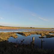
On the fringes of Constable Country, this pretty Parish provides ample walking opportunities and is traversed by the Essex Way
1. From the church gate cross the lane and take the path (part of the Essex Way) along a field edge on the left-hand side of the cemetery. At the end, bear right along the driveway through the environs of Boxted Hall Road to emerge on a lane. Go left, along a straight section leading to a T-junction, and turn right. Pass a left turn (at Greenfield House) but take the field-edge path next left, indicated by an Essex Way sign. Cross a small footbridge and continue on the left-hand side of the next field. Pass a vineyard and a lake, following a gravel track. At another T-junction turn right then after 150 metres take the field edge path on the left, still signed as the Essex Way. The path soon heads off right, across the field to the edge of a spinney to meet a concrete track which leads between the house and barns at Holly Lodge, to emerge onto Holly Lane.
2. Turn left along the lane and follow it all the way to its junction with Boxted Road. Turn right here and then left again, past a gate to continue along a farm track. After 400 metres, at the track junction, turn left then bear right, still on the track, before turning off left along a field edge. Keeping the hedgerow to your left, the path leads to a wooden footbridge. Cross it and turn right; pass a line of trees and the end of a hedgerow, then turn left along a straight path which passes a wooden electricity pole with two cable-stays. This path widens to a lane and leads to Straight Road.

3. At the road turn left and in 370 metres turn right, into Old House Lane, with a mature holly hedge on your left-hand side. For a distance this is an avenue, then just a track. Pass a wooden footbridge on the right then, just before a green metal gate, take a waymarked path on the left. This soon kinks into the neighbouring field and, with the hedgerow on the right, leads towards a wood. Here the path veers right, beside the ominously named ‘Black Brook’, to emerge on the right-hand edge of a meadow. After a wooded section, on the approach to a residence, a waymark indicates a left turn, from where the path narrows beside a fence before emerging on Langham Lane. Turn left, pass Park Lane on the right and Chapel Road on the left, and the road leads to a crossroads beside the Shepherd & Dog pub.
4. At the pub turn left along High Street then take the track on the right, beside a semi-thatched property called ‘Serenity’. Open gaps in two fences indicate a crossfield path leading to a path access into a wooded valley. In the valley, cross a footbridge and a culvert – over Black Brook again – then head up the other side past a pink farmhouse. In the farmyard turn right, passing a brick-built barn on your left, then veer left towards the corner of a small wood. Enter via the stile (or the gate beside it if open) and follow the diagonal path to another stile on the opposite side of the wood. Follow the field edge leading directly away from the wood to reach a lane.
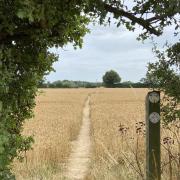
5. Turn left and at the junction with Water Lane pass through the gap in the hedge and fork right on the path across the field towards a large house on the other side. There we meet the Essex Way again, and will follow it for the rest of the walk. At the house perimeter turn left then cross a field leading, over a stile beside a concrete fingerpost, to Sky Hall Lane. Turn left and, at the green triangle at the entrance to Rivers Hall, pass through a gap in the hedge and turn right. The signposted path skirts the outbuildings, leading to a track. Go left, along the track, past a pretty cottage, then keep left, passing a lake, before heading uphill to the junction with Lower Farm Road. Turn left here and the lane leads all the way back to St. Peter’s Church with some gorgeous views along the way, north across the Stour valley and into Suffolk.

COMPASS POINTS:
Distance: 9.0 miles (14.5km).
Starting point: St. Peter’s Church, Church Lane, Boxted: grid reference TL997332; postcode CO4 5GW.
Access: Parking is available to the rear of the cemetery opposite the church on Church Lane (not Church Street). To access by public transport, there is a bus stop at The Shepherd & Dog pub, point 4 on the walk, well-served by routes 81/81A Colchester - Manningtree/Dedham (www.essexbus.info) so start and finish the walk there (maybe visit the pub twice!).
Map: OS Explorer 196 Sudbury, Hadleigh & Dedham Vale.
Refreshment: The aforementioned Shepherd & Dog pub, just over the border in neighbouring Langham, at point 4 on the walk route.
Places of interest: The church has features old and new: Roman tiles are incorporated into the structure; many Norman details can be seen; the brickwork is primarily Tudor; and Victorian tweaks abound as usual. There is even a modern highlight, the chancel ceiling having been painted with an astronomical design featuring the Hale-Bopp comet and solar eclipse of the late 1990s. Among several memorials in one to Sir Richard Blackmore, the writer and royal physician to William III and Queen Anne, who died in Boxted in 1729 and is unfortunately largely remembered for his extensive and widely derided production of epic poetry. The northern part of the walk passes through the Dedham Vale Area of Outstanding National Beauty (AONB – now reclassified as ‘National Landscapes’). Unfortunately there is no public access to the riverbank in the Boxted area, from Nayland in the west to Stratford St. Mary in the east, other than one vehicular bridge (currently closed) and one pedestrian bridge crossed by the Stour Valley Path, a 60 mile trail from the river’s source in Newmarket to where it meets the tidal estuary at Cattawade near Manningtree. Much of the river (Brundon Mill to Cattawade) is however navigable by canoe, kayak or paddleboard. For a more ‘classic’ Constable Country experience head east to Dedham and Flatford Mill where extensive public access to the river valley and flood plain is available. Several scenes featured in John Constable’s famous landscape paintings from the early 1800s can still be recognised in the area today.


