A 5.4 mile walk exploring the undulating hinterland between Epping Forest, the Lee Valley and north-east London

The Walk
1. From the bus stop head north on the pavement beside the main road, passing the ‘Welcome to Essex’ sign. Past the last house, keep to the grass verge on the left hand side of the road then cross a stile beside a metal gate. Follow the grassy track as it sweeps right, eventually crossing another stile. Soon kink to the left, then do so again to access another stile, beside metal railings running alongside the canalised River Lea. Cross the stile and proceed, with the railings to the left. Just the other side of the canal, the bank conceals the huge volume of the King George V reservoir, which can be seen from higher ground later in the walk. After a kilometre, pass through a gate marked ‘Patty Pool Mead’.
2. Turn right just before the next gate and follow the grassy path, through a kissing gate and over a footbridge, then kink right and left to line up with the access road through Ashbrook Court Care Home, emerging back at Sewardstone Road (A112). Cross the road and take the path straight on, beside a metal gate. Pass a small gasworks, then kink left to a stile. Cross the driveway and head uphill, with the hedge on the left. Pause to admire the view from the top, then cross another stile and head downhill on a grassy path adjoining a driveway.

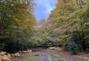
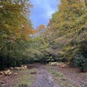
3. At the bottom of the slope, after some steps and a footbridge, turn right along a bridleway, heading steadily uphill. Keep right at the first bridleway junction but at the second, just before a metal barrier, turn left, where a leaning metal sign points towards Lippitts Hill. At the top of the slope the path crosses a golf course, with views off to the right as far as the City of London and Canary Wharf. Continue with the golf course on the left and a Metropolitan Police helicopter base behind the fence on the right.. Pass an unusual memorial to United States Anti-Aircraft Artillery from WW2 before joining Lippitts Hill Lane. Turn right and follow the lane to The Owl pub.

4. From the pub continue south along the lane but after just 50 metres take a footpath leading off to the right, up the roadside bank via a few steps. Pass some chain-link fence, cross a concrete footbridge then veer left. The route meanders round an elevated lake and leads to a point with a wooden gate to the left and metal railings in front, with a view of the golf course. The public footpath continues straight on, onto the course (as the signs suggest, beware of flying golf balls) towards a large oak tree on the left-hand side of the fairway. At the tree, turn onto the tarmac lane by a cattle grid and continue towards buildings on the right-hand side and thence to a crossroads.
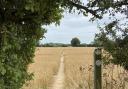
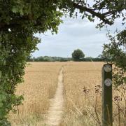
5. This is the hamlet of Sewardstonebury. Cross the road, into Woodman Lane; keep on the lane, a fingerpost beside a horse paddock indicating the route. At its end a kissing gate provides access around a field gate, the path continuing as a grassy track, leading uphill along the right-hand edge of a large grassy meadow. At the top corner of the field, pass between a pair of wooden gateposts then turn left onto a bridleway. Breaks in the hedge alongside the path provide further vantage points for views of central London before the route begins to descend, leading back to the starting point.
COMPASS POINTS
Distance: 5.4 miles (8.7km).
Starting point: The bus stop at the junction of Boardman Avenue and Sewardstone Road (A112): grid reference TQ377960; postcode E4 7QD.
Access: On-street parking is available in Boardman Avenue and adjoining roads. The bus stop is very well served by the 215 Walthamstow to Lea Valley (www.essexbus.info).
Map: OS Explorer 174 Epping Forest & Lee Valley.
Refreshment: The Owl public house in on the route. For start/end supplies Gilwell Stores is just behind the bus stop starting point.
Places of interest: Sewardstone forms part of the wider parish of Waltham Abbey, although it was effectively split from the parish’s main centre when the M25 was constructed between them. Waltham Abbey church has an extensive history. There is evidence of a structure on the site as long ago as the 7th century, since when it enjoyed the patronage of several kings, including Harold II, who is reputedly buried here after being killed in the Battle of Hastings. It became a very grand Augustinian Abbey until the Dissolution under Henry VIII, leaving just a parish church which, although tinkered with by the Victorians, still retains some of the former grandeur and is a fine example of Norman architecture. For over 300 years the town was also home to a major gunpowder/explosives factory, the site of which can now be visited as a museum (check online for opening). Museum lovers may also wish to visit the Epping Forest District Museum at 39-41 Sun Street, Waltham Abbey; admission is free but, again, check online for opening. Gunpowder Park is a country park site on former munitions testing ground south of the M25. It has a car park off Sewardstone Road and provides a rich mosaic of habitats which are home to an increasing diversity of species. Situated within the loop of the walk, the forest around Gilwell Park was reputedly a regular haunt of highwayman Dick Turpin but the site itself has for over 100 years belonged the Scout Association and is a principal site for that movement both nationally and internationally. The site welcomes visitor and offers guided tours.