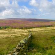
When I told people I was planning to walk to Portsmouth for Lancashire Life I got a few funny looks. The famous city of that name stands about 270 miles away would take about a month to walk to. But this walk, in the countryside between Burnley and Todmorden, takes nearer three and a half hours. It leads to the coastal city’s much less well-known namesake, a small village which nestles at the foot of Cliviger Gorge.
I have read two versions of how the village got its name; one says it’s named after Portsmouth Mill, a textile mill that remains but is in need of renovation. The other tale claims that a local family named Clegg had a son who served in the navy and on his return he named parts of the farm as Portsmouth, Chatham, and Whitehaven. I can find Portsmouth obviously on a modern map and can find Chatham Hill but cannot find Whitehaven. It seems quite likely this story is the reason for the name.
Cliviger Gorge, with its steep craggy southwestern face, was formed as the glaciers of the ice age retreated.

1: Leave the car park and turn left then cross the road and turn right up Green Lane leading between the two school buildings. Walk up the steep hill until the road forks and keep right following the sign saying ‘Pennine Bridleway and Long Causeway’. Go through a wooden gate and carry on to reach a ladder stile on the right with a railway sleeper crossing the stream to reach it. Cross the stile and carry on with a wall on the right to reach and cross a stile into a wood and drop steeply downhill to a stream.
Cross another stile and turn right then cross a footbridge and keep left, going steeply uphill and then follow a series of steps then keep right with a wall on the right. Reach and cross a stile by a metal gate and enter a track and follow this past a house on the right and reach and pass through a wooden gate and keep on the track and keep right as the track forks.
Note: Holme Chapel is possibly named after the small chapel that stood prior to the building in 1794 of the magnificent Church of St John the Divine. The village is named after the home of the Whitaker family called The Holme.

2: On the right of the track is a green metal building and on the left a path leads diagonally left uphill, there is a wall on the left. Keep on the path as it drops down to a stream then turn left and, with the stream on the right, follow the stream uphill until a wire fence comes into sight with a stile in it. Cross the stile then bear right.
There is very little sign of a clear path so, aim uphill towards an obvious steel pylon but keep bearing to the left of it and soon a substation for the wind turbines comes into view behind a wall. There is a metal gate stile in the wall, cross this then turn sharp right and follow the wall on the right to gate and go through this and turn sharp left and follow the path with the wall now on the left.
From here just keep on the path as it goes along Black Scout, passing through a wooden gate. The path reaches a metal gate and a wooden gate side by side, go through the wooden gate and, with the wall on the left, keep on the path. Reach another wooden gate and go through this and turn left and with the wall on the left go downhill then turn right and follow the path with the wall on the left until the path becomes a track and follow this downhill to reach a house at Brown Birks.
Turn left at the house and follow the track. There is a sign saying ‘Burnley Way’. Keep on the track as it goes downhill and bears left to drop into a river valley and then right over a bridge then right.
3: Reach a white gabled house with a bridge before it. Do not cross the bridge but cross the stile on the left leading into Pudsey Clough. Keep on the track with the stream valley on the right. The route is now following the Burnley Way and leads through the village of Portsmouth.
A stile in the wire fence is in poor repair but is signposted ‘Burnley Way; with a very under-used path on the other side of the fence. It is obvious that almost everyone has ignored this section and carried on the main track. The track then turns right but at this point keep straight on uphill with the wire fence on the left to reach a stile on the left. Cross this stile and turn right.
From this point there is hardly a path in sight though there is a post with a yellow marker. We did quite a lot of wandering around and retracing but eventually decided to keep the stream valley on the right. It is the correct route shown on the map but it’s very hard to see on the ground. Keep on and cross a stile then, as another stream coming from the left joins the main stream, drop steeply down into and then out of the stream valley coming from the left and then carry on heading over pathless ground towards a farm but bearing slightly right to reach a track with a bridge on the right.
Turn left and follow the track to reach the entrance of Stiperden House Farm then turn left and follow the road for the farm up to join the main road of the Long Causeway and then turn left. As earlier in the walk the footpath marked is harder to follow than the obvious route. On the map the path runs parallel with the farm road but the signpost for it seems to point up the road and this is a lot easier to walk. Follow the Long Causeway, passing the car park on the right and keep on to meet the Pennine Bridleway coming from the right then leave the road and follow the path that runs parallel to right of the road.
Note: Coal Clough Wind Farm on the left consists of eight turbines each with a tower height of 70 metres/230 ft and each blade is 40 metres/131ft long and when in a vertical position the height from the blade tip to the ground is 110 metres/361 ft.
4: Reach a sign pointing across the road saying ‘Public Bridleway Holme Chapel’. Cross the road and go through a gate, then turn right and follow the path running parallel to the left of the road then go through another gate and turn left and follow the path downhill with a wire fence on the left. Keep following the path as it eventually turns right to meet a junction with a track. Turn left and follow the track as it turns into Green Lane and retrace the route back to the Ram Inn, a family- and dog-friendly pub that does good food and has a good drinks menu – perfect at the end of a walk..

COMPASS POINTS
Start and finish: The Ram Inn car park Holme Chapel. BB10 4SU. Please ask permission.
Distance: 6.5 miles/10.5 km
Time: 3.5 hours
Map: OS Map OL21 South Pennines
Terrain: Mainly good walking on tracks and footpaths but these are indistinct at times and on moorland that can be bogy in wet conditions. A couple of long climbs. Boots essential
Facilities: There are no public toilets on route


