At the end of last year all of our Area's of Outstanding Natural Beauty (AONB's) became National Landscapes and that included our very own Mendip Hills. The new name reflects their national importance, the vital contribution that they make to protect the nation from the threats of climate change, nature depletion and the wellbeing crisis, whilst also creating greater understanding and awareness for the work that they do. Jim Hardcastle, Mendip Hills National Landscape Manager said, 'We have a new name and logo that shows the national importance of the Mendip Hills, but this is still the same beautiful place where people live and work and come to breathe. The new name should grab people's attention and remind them how important the area is if they've lived in the area for years or if they know the place like the back of their hand. And if they've never visited, we look forward to welcoming them and sharing our love of Mendip. There's always more on Mendip!'
So if you like a walk with a fantastic view, big skies and a variety of terrain with a wonderful country pub thrown in, then this is for you. The route is approximately 7km, taking about 2 hours at an adult walking pace. It takes you through farmland, woodland and involves about 1.75km of walking on a country lane. Unfortunately this route isn't suitable for a buggy and is best to wear sturdy footwear as the woodland tracks can be muddy during or after wet weather.
1. Start at the car park at Deer Leap [ST51894927 – W3W explain.books.stag] and immediately enjoy the view over Somerset levels; to the right is the Severn Estuary, to the left Glastonbury Tor. From the car park head downhill on the lane for a few metres and go through the gate on your left; follow the trodden path, to your right slightly, heading across two fields, until you come to a gate at the lane again. Follow the lane down for about 290m until you come to another gate on your left which is slightly set back off the road and where there is an information sign (total section approximately 690m/11mins).
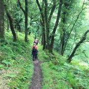
2. Pass through the stile and follow the track; you will cross a small stream shortly afterwards. Carry on along the path, which undulates through the woods, until you eventually climb up and come out of the woodland, with fields on your left and the woods at the top of the gorge on your right. Continue along the path until you reach a stile where another path rises from the gorge below to meet it (total section approximately 920m/20mins)
3. Continue ahead through the stile gate on the path, which switches left slightly and goes across a field, where there are often cattle. On the other side of the field, carry on, crossing over another two fields, until you reach the gate at the drove, a path with hedges either side (total section approximately 600m/12mins).
4. Turn left and walk along the drove until you reach the lane. Turn right at the lane and walk into Priddy. You will come to the Queen Victoria Inn where it would be nice to stop for a pint or a pub cooked meal. Very cosy in winter, with its log fires and warm welcome (total section approximately 2km/30mins).
5. From the pub follow the lane, heading in the same direction, until you reach the village green; turn left here, keeping the green on your right until you come to a smaller lane heading uphill on your left. Take this lane, heading over the stile at the top. Walking almost straight, you will cross fields and some scrub land bound by hedges or dry stone walls (about six), crossing these via gates and stiles until the Somerset levels come into view again. You will eventually reach a dry stone wall ‘corner’ where there is an information sign ahead of you and a stone stile to your left.
6. Take the stone style to your left and you will see the Deer Leap car park. Cross this open access land to where your car is parked and take in the view once more (total section approximately 2.6km/42mins).


