Health walks in Somerset are organised by Somerset Health Walks in conjunction with the Somerset Activity and Sports Partnership (SASP). Original Health Walks take place on Tuesdays in Crewkerne, and recently complemented by a shorter fully accessible beginner walk on a Thursday and a monthly family walk on a Saturday also accessible and buggy friendly. These walks, led by volunteer walk leaders, not only provide an opportunity to explore the county at its finest but also foster a sense of community among our walkers, a spirit that is in abundance in Crewkerne. With its idyllic countryside surroundings and welcoming atmosphere, Crewkerne offers a delightful escape for those seeking a taste of rural Somerset and a warm welcome no matter what walking level you are.
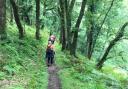
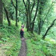
This walk begins in the recreation ground behind Crewkerne Aqua Centre and ends in the town centre an hour or so later, usually in various coffee shops. The nearest parking is in South Street car park, where charges apply. This particular walk is a favourite in summer, but can be a challenge in the winter, or indeed when the stinging nettles are at their height. It is, however, a lovely mix of town and country. Good, sturdy walking boots are recommended.

1. Start by following the tarmac path around to the front of the Aquacentre. Do not cross at the zebra crossing towards Waitrose but follow the path past the Luccombe Oak tree and the George Reynolds centre. Cross towards the Henhayes Centre and follow the path as it curves left. At the end of the row of parked cars, take the first turning on the right (before Lidl's car park). There is no sign, but this lane is called Cossins Lane. You will emerge into Orchards Lane. Turn left here and, on reaching East Street, turn right and walk as far as the zebra crossing.
2. Cross at the crossing, then walk up Clammer Hill Lane, which passes behind the old Crewkerne Grammar School, now converted into apartments. Continue all the way to the top, where it bends to the left and passes behind Wadham School. Carry on to the end of this path, which is known locally as Fox Ditch. At the end, cross Ashlands Road, turn left, then take the first right into Maple Drive. At the end, turn right into Aspen Way and take the footpath between some houses on the left, emerging onto a track.
3. Turn right here, passing behind the housing development, then along a path between two fields and over a stile. From this point you will be walking alongside a barbed wire fence. The path can be quite narrow here, so take care. The path turns first left, then right and over a second stile into a field.
4. After crossing this stile, turn left, then right, following the field boundary, to a crossroads of paths by a large water tank, where you will see a solar farm more or less ahead of you. Turn right here and follow the well trodden path along the field edge, taking care when passing by some deep water, emerging onto a farm track leading to the A30.
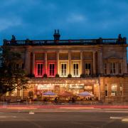
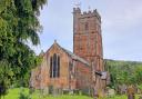
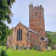
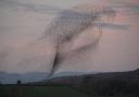
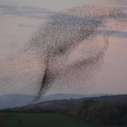
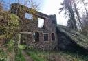
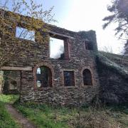
5. Turn right along the A30, passing a brick "pillbox". Built in about 1940, but only rediscovered in 2014, it is now Grade II listed. A few yards further on, cross Ashlands Road and continue down the hill back into Crewkerne, crossing at the zebra crossing and turning right to return to the town centre. Here you will find several cafes and pubs, together with a local information centre and a museum (please check opening hours if you plan to visit). The centre of Crewkerne is a conservation area, with some fine architecture and a beautiful 15th/16th century church - St Bartholomew's.
Compass Points
1. Look out for historical buildings!
2. 1 stile on route
3. Opportunity for refreshments after the walk in the town centre
4. Dog friendly – but do keep on leads when appropriate
5. Toilets located at the start and finish