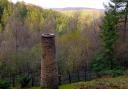
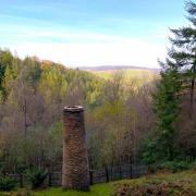
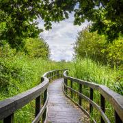
The sky grew very dark, the wind picked up and hailstones started hammering down upon me and my map - the changeable weather of our isles! Normally in this situation you would run for the nearest shelter and wait for the storm to pass. As I was high on Winsford Hill there was little shelter, and besides, I was meant to be working – I was making a map. HARVEY Maps is an independent mapmaking company based in Scotland and we make waterproof maps for walkers. All our mapping is created from scratch, based on aerial photography, using a sophisticated process called photogrammetry. We can view the images in three dimensions which allows us to clearly define all the features we want to put on a map – paths, roads, rivers, buildings and such. Crucially, because we can see in 3D we can measure the height of the land, and plot contours accurately. The resulting map is pretty good, but it isn’t perfect, yet. You can’t see the network of paths in a dense forest, for instance, and steep sided, wooded valleys can hide features within the shadows. And what if someone builds a new housing estate between the time the photo was taken and the map is published? This is why we send surveyors out to thoroughly check the map and why I was caught in a hailstorm on Exmoor!

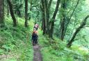
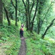
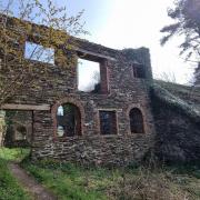
Whatever the weather, the survey stage of making a map is the part the production team look forward to the most. We have spent months in an office making a map and now we get to see it in real life. Four of us headed down to Exmoor where we would stay for more than a week and thoroughly check the map. We divide the area up into individual day walks and each surveyor heads out, walking solo, on a route designed to take in as much as possible. We head for the high land with good views; we check the map matches the features on the ground. Carefully scrutinising a view with binoculars will often reveal something not marked on the draft map, a new fence line for instance. Frequently, and in Exmoor National Park in particular, there is a lot to check in woodland. I personally spent an entire day in Hopcott Woods, near Minehead, following miles of paths which were hidden by the tree canopy. My colleague Luke joined me, 'Not long after I started walking, I ran in to a woman called Emma, who was heading over the moors in a small utility vehicle. She had spotted my map board and thought I was an artist. After I explained what I was doing, she revealed that she was on her way to feed her herd of ponies, and would I like to join? Of course, I jumped at the chance! As we approached the herd it was clear that they recognised Emma, who knew them all by name. They hurried over, keen for their breakfast (and seemingly unbothered by my presence). The herd even included a foal, less than a week old. After they had had their fill Emma kindly dropped me back where we met, and I continued with my walk. Not your usual start to a survey day but one I won’t forget in a hurry!'

We carry both high tech and low tech equipment with us: GPS units track our locations as we walk, so by simply following along a path, that line will be recorded and we can add it to the map. We also take with us a copy of the draft map, printed on waterproof paper (very important) and stuck to a lightweight board. All the features we spot, changes we need to make to the map, road numbers, locations of new buildings, pubs, cafes and so on, are all noted down there and then, to be transcribed and added to the master map back in the office. We usually have a set route to follow, and a rendezvous point to meet the rest of the team at the end of the day, but if we find something on our walks that requires further investigation we have the flexibility to do so- when we find an unmarked path it is our job to find out where it goes! Cameron is another member of the team who joined us on Exmoor, 'Out of the handful of surveys I've been on with HARVEY maps, Exmoor has been by far the most rewarding on a cartographic level. There's plenty of work for us to do on the ground, exploring the dense tangle of paths and tracks inside steep wooded valleys; the holloways sunk deep into the ground by the passage of hundreds of years of traffic; the extensive and well-signed rights-of-way network; the faint trods crossing the expansive moors with their open vistas. Exmoor's equine essence was especially evident on survey too; traversing the moors from Lynmouth to Simonsbath I met many more riders than walkers, and it was nice to see that the bridleways are used as such.' We can easily cover 20-25km in a day and once we're back at our accommodation we discuss our findings, dry out our kit and plan the next day’s routes. As much as we’d like to tour the pubs of Exmoor more often than not it’s an early night, ready to head out onto the hills the next day!

Back at the office, the map is updated, undergoes rigorous checks and then is prepared for printing. Interestingly, all our large format maps are printed in Frome, Somerset, by specialist map printers Dennis Maps. 'We have been working with Harvey Maps for quite a few years now, and it is nice to print a map that is local to us', said Roger Gilson, Operations Director. The whole process of making a map usually takes 6 to 9 months from start to finish. Often when we meet people when out on survey, they are amazed that we are paid to walk the hills. It’s true, it is a fascinating job, and it means we get to visit more places than we would normally. We hope that the maps we make are a gateway for others to experience the landscapes we have walked through and see the views we have seen.

HARVEY Maps are offering an exclusive 15% discount for Somerset Life readers:
Head to harveymaps.co.uk and enter the promo code: SOMERSET15
Ts&Cs: Coupon redeemable against cart Subtotal. (VAT and shipping costs are added after coupon is applied). Input coupon code at cart or checkout to receive discount. A minimum order of £5 is required. Code expires 31st July 2024.