Imagine digging blocks of peat out from the moist Somerset Levels and you uncover pieces of wood. Do you shrug and ignore them as of no interest, or do you contact archaeologists? In 1970 Ray Sweet faced that decision. If he'd shrugged and carried on digging then we wouldn't have known about one of the world's oldest trackways.
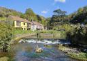
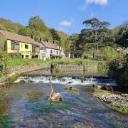
Flooding is nothing new. Some of our ancient forebears eked an existence in the boggy lowlands which have always been prone to flooding, and were much wetter thousands of years ago. To travel across the marshy landscape they probably navigated water channels in dugouts or rafts. But what of ground that was too wet to walk on and not deep enough for a boat? Over these areas they erected wooden walkways such as the Sweet Track. Other trackways are the Abbot's Way linking the islands of Westhay and Burtle, the short Walton Heath hurdles, and the Meare Heath Track that used crossbeams reminiscent of railway sleepers.

Since at least 6,000 BC humans made their home in the Levels, adapting to whatever challenges nature threw at them. Before the Roman conquest of Britain some lived in lake villages. Built around 250 BC, the Glastonbury Lake Village could be situated on wet ground by laying a foundation of timbers containing clay, bracken and rubble. Living in groups of roundhouses, the inhabitants survived on a mixture of farming and hunting or trapping animals. Semi-aquatic wetland mammals like otters were part of their diet, and also beavers long before they were hunted to extinction.
Modern Britain has been influenced by various invasions. The Romans made their way here in the first century AD and, fortunately, left written records as well as remains of their villas and other buildings. Their advance across vast swathes of our island reached Somerset where one of the innovations they brought was technology to drain the land, making it more suitable to farm and build on. When the Romans left they wouldn't have foreseen that nearly two millennia later a stash of their coins would be found at Shapwick. A day in September 1998 is one to remember for two metal detectorists who discovered silver denarii coins in a farmers field. Known as the Shapwick Hoard – one of several hoards found in Britain – digging unearthed over 9,000 coins, though a number had been damaged from ploughing. Many were found in rows on their side, most likely in coin rolls made from material that eventually rotted away.

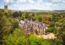
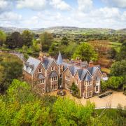
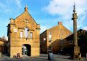
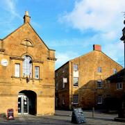
Even substantial buildings could be located in certain parts of the Levels. Fast forwarding several centuries takes us into the Middle Ages and an abbey built at Muchelney. The original abbey, founded by King Ine of Wessex, probably dated to the year 693. Unfortunately, all that remains now of the first building is its foundation walls. The name Muchelney derives from Old English and Anglian meaning a great island surrounded by marshland. Viking raiders damaged the abbey which was rebuilt in the 12th century after Benedictine monks had established themselves there in the 10th century. During recent severe floods Muchelney Abbey barely stood above the water level, yet flooding in the Middle Ages was worse. In 1243 the great island proved to be insufficiently high when the abbey became “distressed by water”. A 12th century monastic writer had described it as reachable on foot or horse in summer but never in winter.
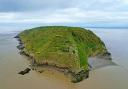
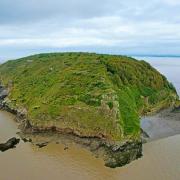
In the same period, motte and bailey castles were a typical fortified enclosure ideal for the Levels since they're built on raised ground to aid defence. A bump of land partly covered by vegetation and trees in Wookey is all that remains of Fenny Castle which may have been built during the reign of King Stephen. Being up to 11m above ground level with a river course to the north-west, it enjoyed a strategic position. No longer visible is a paved causeway running to a nearby hamlet.

Although people were accustomed to the risks of life in the ancient lowlands, even they were shocked in 1607. That year the Levels, along with other parts of southern England and Wales, were hit by devastating floodwaters rising from the Bristol Channel. A drawing from the time shows people clinging on to trees and sitting atop a roof. It was reported that “huge and mighty hills of water” swept inland faster than a greyhound can run, making beggars of rich men before noon. Whether a tsunami or storm surge caused that inundation has been debated. For those living on the Levels it must have seemed like a warning from god to change their supposedly wicked ways. Only sparse evidence reminds us of the people whose short and tough lives in the Somerset Levels played out mostly unrecorded. To get a taste of the past, reconstructions of buildings from different eras can be experienced at the Avalon Marshes Centre in Glastonbury. People have constantly adapted to the vagaries of Mother Nature and tamed the land she provided us with. And while the Levels continue to be affected by flooding, it's a testament to our distant ancestors that they survived in a landscape so difficult to travel over.