The 1972 Local Government Act and resultant 1974 reforms changed the county landscape forever. we take a look at the locations on the edge of Yorkshire.

Stanedge Pole
Marking the border between Yorkshire and Derbyshire, the 450-metre high Stanage Edge feels like a frontier, complete with border post. Viewed from a distance, Stanedge Pole, set back from the Edge, looks like a boat adrift on a sea of moorland. The hull is a cluster of rocks and the white-painted larch trunk makes a convincing mast, sheathed at its foot by a band of iron rods and topped by a metal cap. Some believe the original pole could have been erected to mark the frontier between the former kingdoms of Mercia and Northumbria as indicated on the baseplate.
From the Edge there are superb views across the Peak District. The chimney and cylinders of the Hope cement works and the stegosaurus profile of the more distant Chrome Hill seem to belong to another country let alone county.
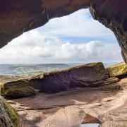
Head up to the Edge and pole from the Hooks Carr car park and on your walk also check out Robin Hood's Cave and the millstones.

Sedbergh
Sedbergh lies within the West Riding and Yorkshire Dales national park but is also part of Cumbria. In this book town what looks like a bus shelter is actually a book shelter. Sedbergh is dominated by its 16th century public school. You can get a good view of its magnificent playing fields, once graced by England rugby players Will Carling and Will Greenwood, from a public footpath running up from the River Rawthey.
Start your 2½-mile stroll by heading to New Bridge to the east of the town then follow the south bank of the river to the next road bridge, cross it and continue on the north bank and through the old Akay estate. In the woods you can find floor tiles from the mansion built by the town's chemist and druggist Charles Edward Taylor in the late 19th century and demolished in 1938. Easier to spot is the recently restored summerhouse folly known as the pepperpot and owned by the school. For more information see bit.ly/Akayestate.

Baldersdale and Lunedale
These two dales in the North Riding are perfect for a half-day bike ride. Starting from picturesque Cotherstone head initially towards Hury Reservoir. Use the hide at Blackton Reservoir for some bird spotting. The farm here, Low Birk Hat, was home to Hannah Hauxwell, a hill farmer, who worked alone and without power or running water for 50 years until her retirement in 1988. Her unbelievably harsh subsistence was portrayed in Yorkshire Television documentaries in the 1970s. The nearby Hannah's Barn visitors centre explains how the adjacent upland hay meadow is one of the rarest natural habitats in the country and Site of Special Scientific Interest.
Cycle along the dam of Balderhead Reservoir, over the high moor and into Lunedale. The fourth and final reservoir, Grassholme, is an ideal rest spot featuring a new observatory, cafe and shop. The last port of call, Romaldkirk is a real gem boasting the recommended Rose and Crown inn, stone cottages around three greens, mini-cathedral of a church, pair of stocks and water pump. Distance: 18 miles. Online map: bit.ly/Baldersdale.

Yarm
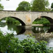
Yarm is enclosed within a meander of the Tees that used to denote the political county border, nosing audaciously into County Durham. Only the 500m-wide neck of the meander prevents Yarm becoming an island. The broad high street echoes Northallerton, Thirsk and Bedale of the North Riding with quaint wynds leading off it adding to the appeal. The bridge over the Tees is impressive but dwarfed by the Victorian railway viaduct that soars and saws through the length of the town.
Originally a tollbooth, Yarm town hall has recently reopened after restoration as a heritage centre. New artworks on the ground floor include a silver nose cast in honour of 18th century war hero Sir Thomas Brown who had his nose cut off in battle, a Viking helmet, and a flood bell and lion from the Tall Trees nightclub, all presented in a replica of an Iron Age canoe found when the railway viaduct was built. You can see Sir Thomas's headstone at St Mary Magdalene's Church.

Bawtry
Bawtry is as much a grand gateway to the south of the county as Yarm is to the North Riding. Fittingly, the picturesque Georgian town used to feature an address of 'Number One Yorkshire' but now that's just the house name.
Bawtry has continued to thrive despite three successive transport related setbacks. In the 12th century it became established as an inland port based on the River Idle, reflected by the location of St Nicholas' Church just off centre to the present town and near the original course of the river. The opening of the Chesterfield Canal in 1777 marked the beginning of the end of Bawtry as a port. Its position on the Great North Road subsequently made the town an important coach staging post but the coming of the railway in the mid-18th century put paid to that. The station closed in the 1960s when the town was also bypassed by the new A1.
A 24-point heritage trail is available from the Heritage and Information Centre and the town has an excellent choice of places to eat.

Barnoldswick
Called Barlick by locals, Barnoldswick has such a split identity that welcome signs for the town bear both the red and white roses of Lancashire (to which it was politically relocated in 1974) and Yorkshire, respectively. Well worth a visit, Barnoldswick Town FC competes in the North West Counties League, the fifth tier of non-league football. Named the Silentnight Stadium after the bed manufacturing company headquartered in the town, the club's characterful ground seems embedded in the community and environment. One stand has the stonework of a barn and the Pennine fells provide the backdrop.
Find out about Barnoldswick's industrial history by visiting the Bancroft Mill steam engine museum and walking the 2-mile Stream & Steam Heritage Trail which ends at the football ground. Download a booklet from bit.ly/Barnoldswick. Alternatively, cycle or walk to Barnoldswick along the towpath of the Leeds and Liverpool Canal starting at the recommended Wharf at Foulridge cafe.
Look out for Barlick Beach, a pop-up covered beach complete with donkeys that runs during August, and the town's Festival of Fire and Ice every January.


